Planners on Dec. 11 revealed early ideas for new corridors that would enable bicyclists to ride around O’Hare International Airport safely.
It’s part of the Cook County Department of Transportation and Highways’ O’Hare Area Bike Network Study, a “subregional study” started in 2025 to “create a more connected bikeway network” around the airport. It’s one of 12 study areas stemming from the 2023 Cook County Bike Plan.
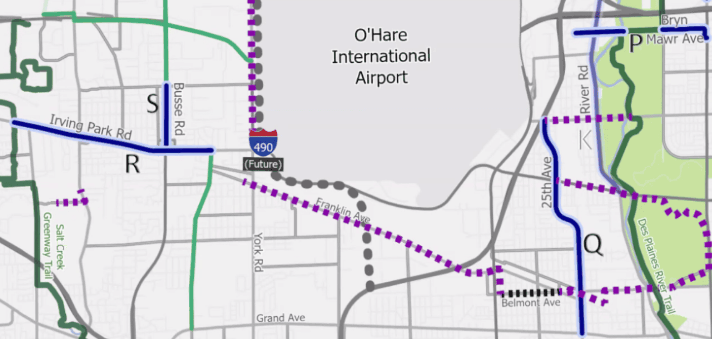
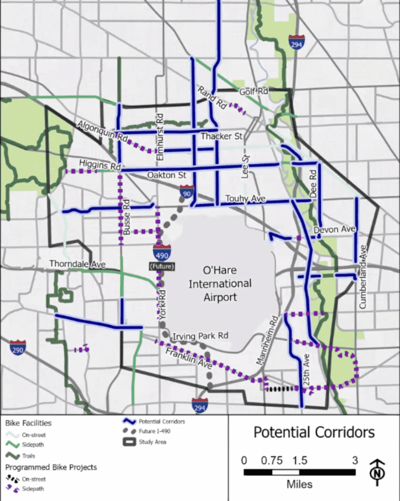
Bicyclists would have dedicated space to ride east-west stretches like Thacker Street, Algonquin Road, Oakton Street and Touhy Avenue, and north-south stretches such as Busse Road, Mount Prospect Road and Wolf Road north of the airport.

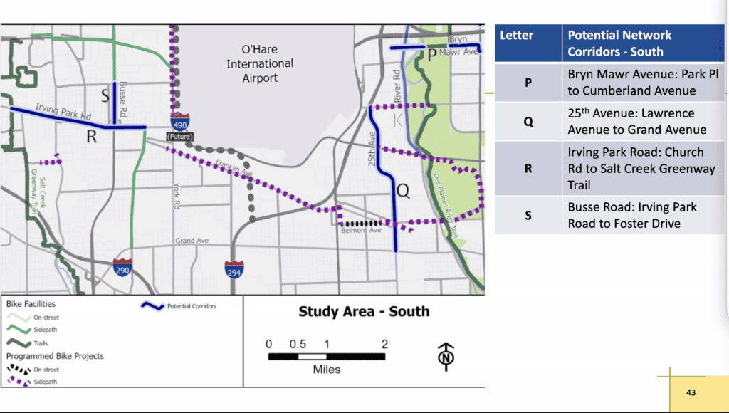
They’d be able to ride York Road along the west side of the airport down to Green Street/Franklin Avenue along the south side of the airport. There they could ride east to Belmont Avenue, to the Des Plaines River Trail and into Chicago.
East of the airport, they could ride north and south not only on the trail but also on 25th Avenue, River Road, Cumberland Avenue and Dee Road.
Planners are studying facilities such as bike lanes and off-road paths to make all these connections, plus safety improvements at intersections. The goal, planners said, is a “network density of a mile or better between bike facilities.”
The study and survey
The study area includes all or parts of Bensenville, Chicago, Des Plaines, Elk Grove Village, Franklin Park, Mount Prospect, Park Ridge, Rosemont and Schiller Park.
A steering committee made up of representatives from local communities was formed for the study. Interviews “with key stakeholders” — including members of bike clubs in Des Plaines, Elk Grove and Park Ridge — were conducted in addition to a public survey, and virtual public meetings and four bike tours are being hosted; three bike tours were done in 2025.
The 575 survey takers were spread out among Chicago’s Northwest Side and all the suburbs surrounding O’Hare. Of them, 300 ranked “lack of bicycle infrastructure” their top challenge to biking. Another 104 listed that as the second top challenge. Aggressive driving and physical barriers were other top challenges.
Specifically, respondents commented on connectivity concerns such as a lack of bike lanes and safe crossings, and drivers passing unsafely.
The survey takers also brought up several roads. I-294 and I-90 topped the list, presumably as difficult to get around. Then virtually all the busy roads such as Northwest Highway, Algonquin Road, Touhy Avenue, Mannheim Road and Oakton Street got comments.
But the Des Plaines River Trail got the most mentions of all. That suggests riders are either seeking access to it or improvements to it. (Many improvements have been in the works.)
Key connections
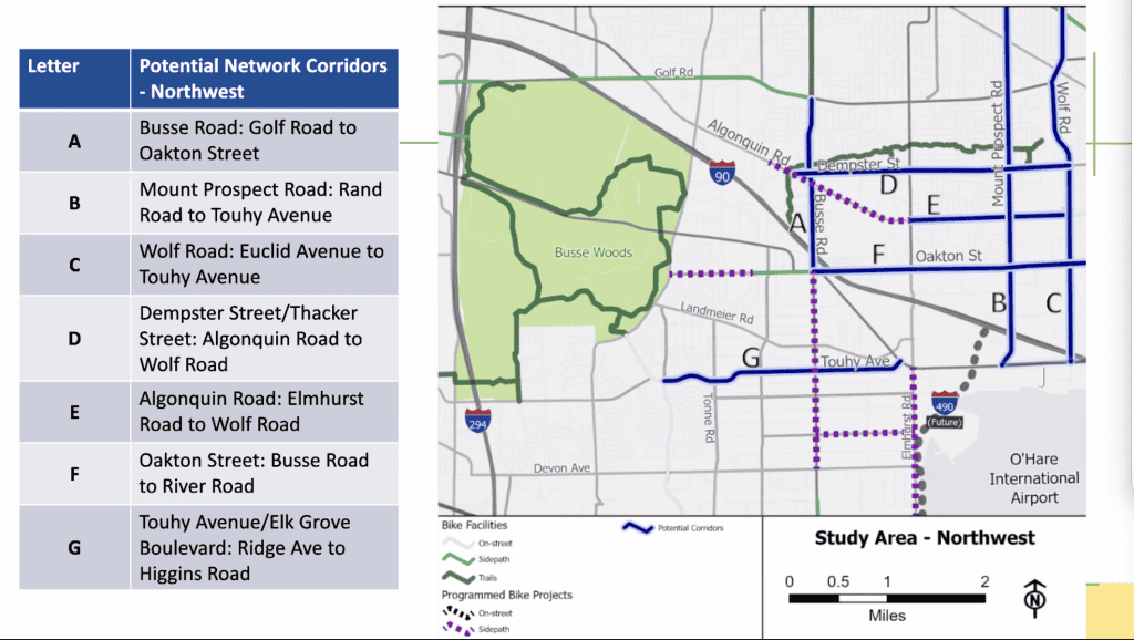
The Des Plaines River Trail clearly is a top bicycling destination in the suburbs, but also clearly, bicyclists from the suburbs west of O’Hare have a hard time getting to it without driving. Riders from Des Plaines, Rosemont, Park Ridge or the suburbs east of O’Hare have the advantage.
Meanwhile, the riders east of O’Hare look at Busse Woods, west of Elk Grove Village and Arlington Heights, as a destination. The popular forest preserve with its 7.25-mile trail loop plus offshoot trails came up often in the Dec. 11 public meeting.
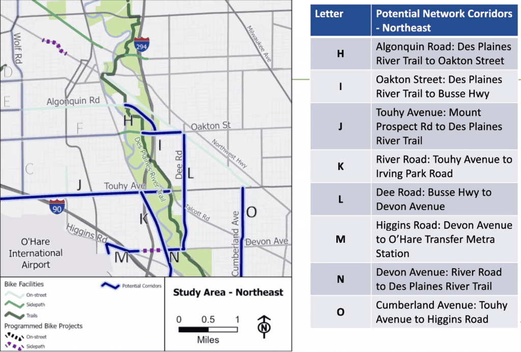
All in all, planners envision corridors with which bicyclists could ride the Des Plaines River Trail and Busse Woods trails in a single trip. Or just simply traverse Des Plaines to get to Elk Grove Village, Arlington Heights and Mount Prospect. Or Elk Grove and Arlington Heights bicyclists could ride to Park Ridge.
But moving around the south end of O’Hare seems to be a particular pain point. Especially with jobs in and around the airport, commuters seek safer options.
So planners also see corridors from south Elk Grove Village, Wood Dale and Bensenville to Franklin Park, River Grove, Elmwood Park, Schiller Park, Rosemont, Norridge, Harwood Heights and the Northwest Side of Chicago.
When could this happen?
Well, this could all take a while.
It so happens a little bit of work to support bicyclists is already happening in the area. Preliminary work to reconstruct Touhy Avenue between Elmhurst and Mount Prospect roads began in late fall 2025; the real work will take place in 2026 and 2027.
Touhy will be elevated over the I-490 tollway being constructed now and nearby railroad tracks, Mount Prospect Road and Old Higgins Road will be realigned, and the intersection of Touhy and Elmhurst will be improved. Plus, a side path will be built on the north side of Touhy and the east side of Elmhurst.
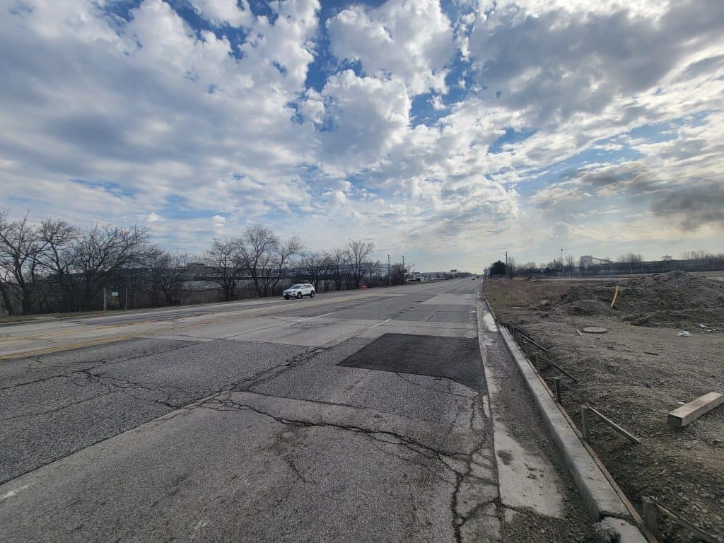
Down south, Franklin Avenue/Green Street in Franklin Park and Bensenville will be reconstructed. The two-lane road will turn into a five-lane road, and a side path will be installed on the south side. This work has started and is expected to continue into 2027.
As for the rest of those favored corridors, the planners on Dec. 11 said it could take “10 to 15 years.”
In fact, they’re still collecting feedback that “will culminate in a final report with prioritization and implementation strategies targeting early 2026.”
The planners said to watch the project website for updates.
• Did you like this bit of news? Consider donating to help defray the costs of bringing information like this.