This is a compilation of quick news relevant to suburban Chicago bicycling interests. Click on a numbered line below to jump to a specific item. Last updated Dec. 3 for items on Naperville and Harvard, and Nov. 18-19 for Mount Prospect news, and edits about River Forest and Wilmette.
Bike path along Quentin Road to Deer Grove
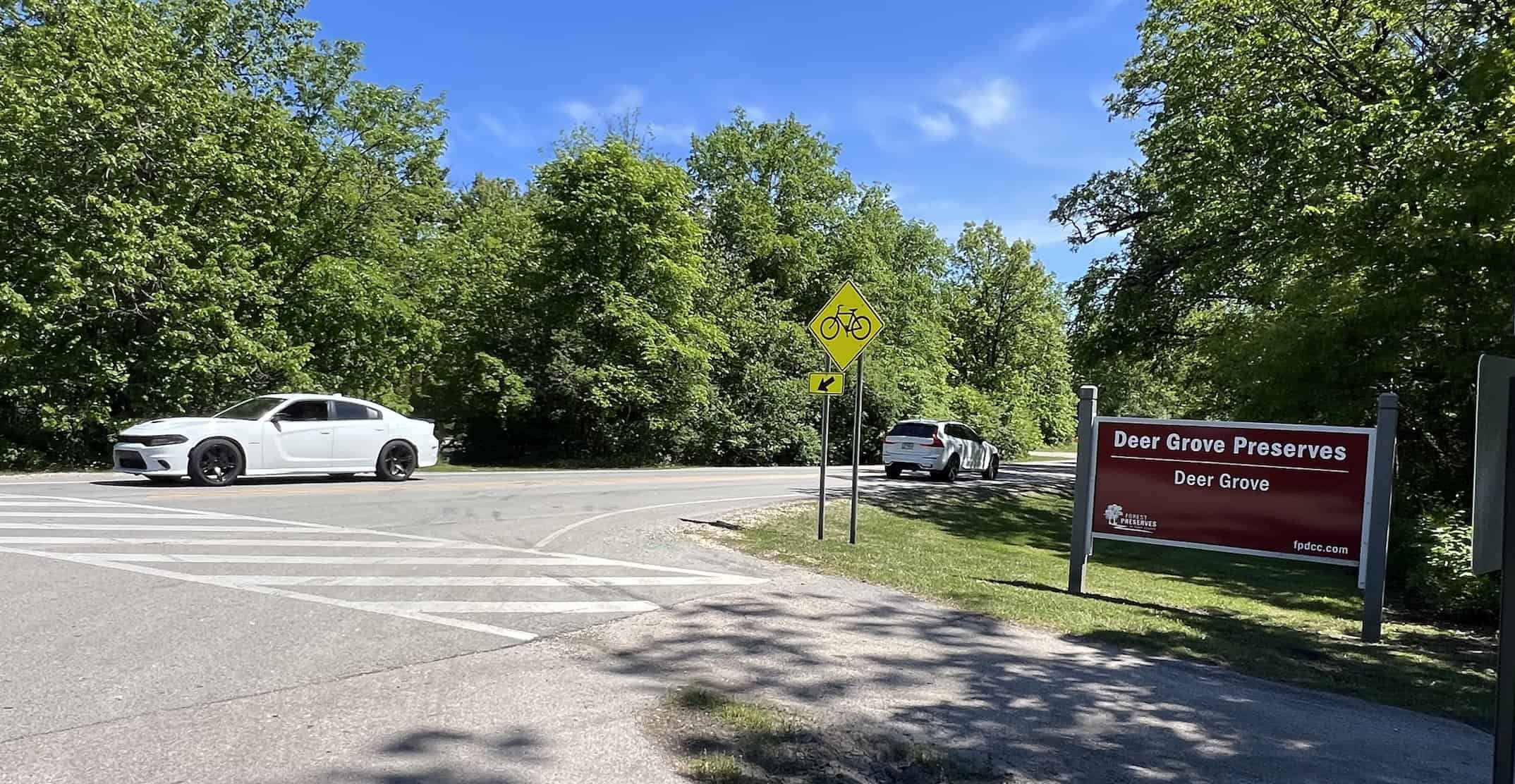
The last of public feedback was being taken on the latest proposal to rebuild Quentin Road, with an off-road path, through the Deer Grove Forest Preserve.
The Cook County Department of Transportation on Nov. 6 held its most recent open house about the milelong stretch of Quentin between Lake-Cook and Dundee roads. Feedback to be added to the public record was being taken via email through Dec. 12, this web page says.
The latest proposal would install an off-road path off the east side of Quentin. On the north end, the path would extend one on the other side of Lake-Cook Road, finally providing a safe way for bicyclists to ride south to Deer Grove and into Palatine.
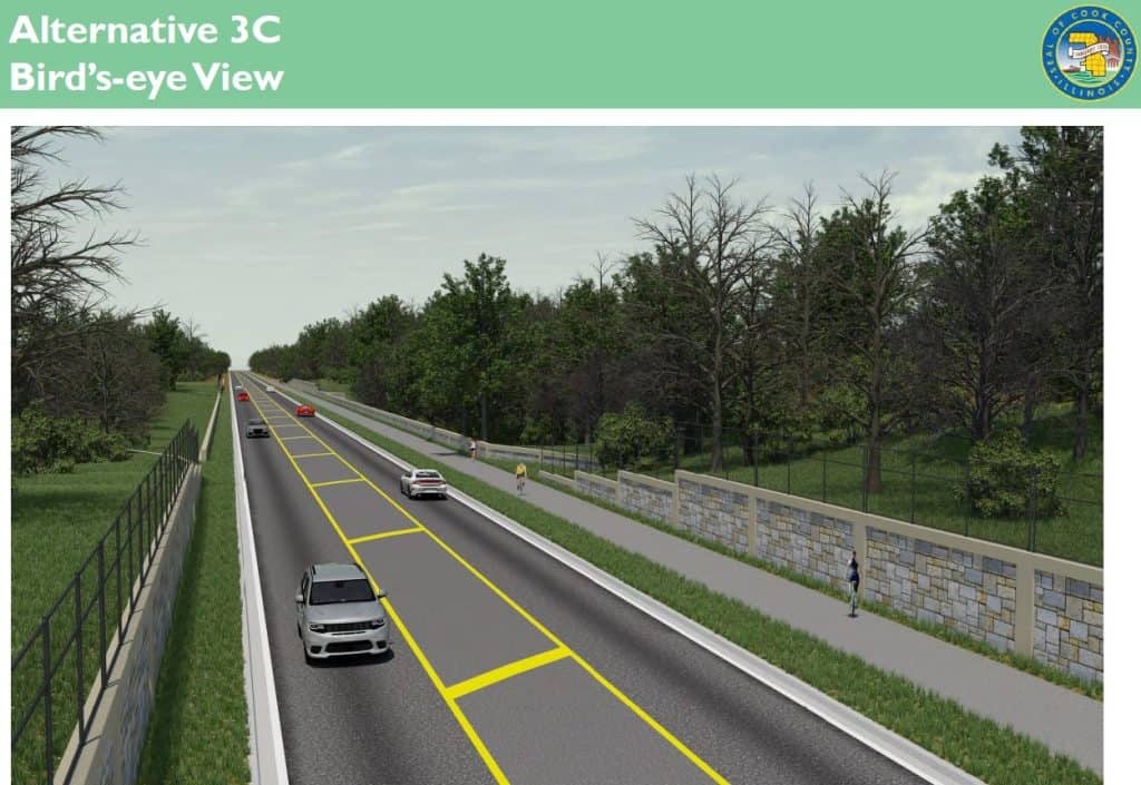
The proposal also will turn the two Deer Grove trail crossings at Quentin into one and provide a refuge island in the center of Quentin. Now trail users must watch for speedy traffic as they cross Quentin.
The proposal would keep one lane of traffic on Quentin in each direction but add a center turn lane.
Studies have been done and public input taken since 2015. Residents have been split on whether to expand Quentin to two lanes of traffic in each direction or leave it at one. Advocacy and local environmental groups have pushed for the fewer lanes and the bike path.
After the latest public feedback period, Cook County presumably will move to approve Phase 1 design and engineering studies. Those would take at least a year, and then more detailed designing would come. Funding has to be procured. Construction is not slated until at least 2029 under the current timeline.
Naperville updating its bike plan
Naperville has launched a campaign to update its bike and pedestrian plan by taking input from residents. An interactive map on which people can leave comments was available through Dec. 31, 2025.
The city says the project is part of Naperville 2027: Investing in Our Community Priorities Plan. “A goal is for the plan to help pinpoint projects (e.g., enhancing existing infrastructure and developing new routes) to improve the ease and safety of walking and biking throughout the city,” the project web page says.
The city first created a bicycle and pedestrian plan in 1997. “Pop-up” events have been scheduled from September to January 2026 to gather residents’ input; the timeline suggests a public open house by April, with a final plan created by October.
Mount Prospect adding paths along Algonquin, Busse roads
Mount Prospect leaders are moving forward with plans to build bike paths along two main thoroughfares through town.
One is an 8-foot-wide path off the north side of the whole of Algonquin Road that runs through the village, about 1.7 miles. It’s part of an effort specifically to improve bicycling and pedestrian safety along the corridor, which is dark in some places even with shops and restaurants along the road.
Adding to the lighting is part of the plan, which has been in the works since 2022. Pedestrian deaths and injuries are often reported at intersections, such as at the Algonquin-Dempster Street-Busse Road triangle.
On Nov. 18, 2025, the village board approved an agreement with a data center developer to contribute $1 million toward the Algonquin Road improvements, particularly at the intersection with Linneman Road, as part of the Mount Prospect Technology Campus taking shape.
The second is a plan, also approved Nov. 18, with Cook County to build an 8-foot-wide path as part of Busse Road reconstruction from Central to Golf roads, about 1.25 miles.
Busse Road now “has a rural profile with an open ditch system and driveway culverts,” the village says. Ideas to improve the road were first presented to residents in 2017. There were alternatives for two lanes of traffic in each direction, or one lane in each direction with a center turn lane, for three lanes total. In 2019, the three-lane option became the preferred one.
Planning and designing began in 2020. Adding curbs, gutters and sewers will be part of the work. And the multi-use path will be built off the east side of the road.
Construction on both projects is scheduled to begin in 2026 and conclude in 2027.
The village has been studying how to add bicycling infrastructure to arterial roads through town; it released an “existing conditions report” in June 2024.
A bigger development coming to Mount Prospect in 2026 is a bike-pedestrian bridge over Northwest Highway/Route 14. It will connect Melas and Meadows parks.
New Busse Highway with bike lanes, fewer auto lanes

Member of the Park Ridge Cycling club on Oct. 11 celebrated the new Busse Highway through Park Ridge and some of Des Plaines, revamped with fewer auto lanes and new bike lanes.
The “Busse Highway Road Diet” was more than seven years in the making. It was first suggested as part of the 2018 update to the Park Ridge Bike Plan, which suggested adding bicycling facilities on various streets in the city. Ride Illinois and the Active Transportation Alliance helped prepare the bike plan in concert with a Bike Task Force that the city established.
Busse Highway was perhaps the biggest project in the plan. In large part that’s because the street is controlled by IDOT, and IDOT was planning to resurface the road. The city got IDOT to reconfigure it, too — eventually.
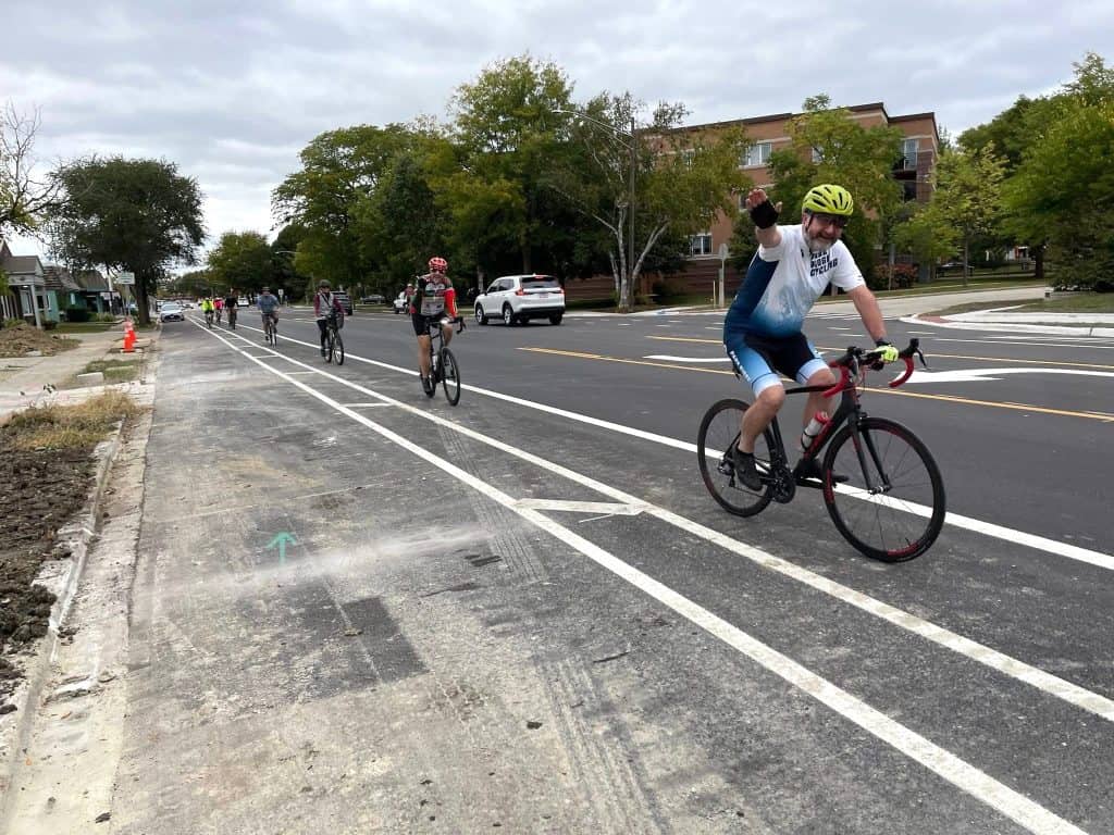
The revamp covers nearly the full length of Busse Highway, 3.1 miles, from Morris Street to Potter Road in Park Ridge and from Potter to Miner Street in Des Plaines. Instead of four lanes of auto traffic, the street now has one lane of auto traffic in each direction plus a center turn lane.
Then it has one bike lane on each side, between on-street parking and the auto lane. The bike lane is 4 feet wide, and there’s a painted buffer of a couple of feet between it and the parking spaces. It’s not quite a “protected” bike lane, but it’s the most on-street space in the city devoted only to bicyclists.
The bike plan said studies showed that traffic was well below the limit for reducing lanes on Busse Highway, and bicycling on the major throughway that goes by homes and businesses was uncomfortable for all but the more advanced bicyclists.
Since 2018, there were not only typical delays with IDOT’s schedule as well as, of course, the COVID-19 pandemic, but also a little hold-up involving parking on 1,000 feet of Busse Highway between Parkwood Avenue and Potter Road, which also involved the intersection with Oakton Street plus nearby train tracks. The resolution to that dispute between IDOT, which wanted the parking removed, and the city, which did not, is not to run the bike lanes on that section and steer bicyclists to the sidewalks.
Police warn of attacks in two Cook County preserves
Cook County forest preserve police on Oct. 27 warned of attacks in two locations and said they’re increasing patrols as a result.
A forest preserve district Facebook post cited incidents over the Oct. 25-26 weekend at Busse Woods between Elk Grove Village and Schaumburg, and LaBagh Woods on Chicago’s Northwest Side.
“At Busse Woods, a group of youth on bikes were riding into other visitors on the trail and throwing water bottles and other objects at people,” the post said.
“At LaBagh Woods, when a 33-year-old man on the Weber Spur trail asked a group of five men on motorbikes to be quieter in the woods, they confronted and assaulted him, using racial and homophobic slurs.”
The post said police are investigating and have increased patrols, including on the trails, at the two preserves. Forest preserve police were seen Oct. 27 on the Elk Grove side of Busse Woods, near Grove 27.
The post said you could call the forest preserve police at (708) 771-1000 with information, or 911 in any emergency while out on the trails.
River Forest pitches Washington Blvd. bike-ped plans
The Village of River Forest held an open house Nov. 6 to show residents early ideas to improve a little more than a half-mile of Washington Boulevard, including its bicycle and pedestrian facilities.
The plans include bike lanes on both sides of a portion of the road with a painted buffer, then an off-road, 8-foot-wide path for the rest of the stretch.
The village says on a web page it has been studying the corridor since receiving complaints of speeding a few years ago. It commissioned a village-wide traffic study in 2023 to review traffic conditions, including on Washington Boulevard. In April 2024 it added traffic-calming measures.
Washington Boulevard is a designated bike route in the village, but it has only sharrows, not bike lanes or paths. It has a 25 mph speed limit.
The village says the Washington bicycling improvements would connect to a future trail on Thatcher Avenue. That trail is planned between North Avenue and Madison Street, which River Forest is working with the Village of Rosemont on, according to the Journal of Oak Park and River Forest.
“Additionally, the project includes a road diet, bumpouts, ADA improvements, and various other traffic calming measures that contribute to bicycle and pedestrian safety,” the village said. Washington Boulevard has only two lanes of traffic total now, plus parking lanes.
Phase II designs would begin next year, and construction is anticipated for 2027.
Residents can provide comments by emailing WashingtonCorridorProject@primeraeng.com.
Wilmette plans new bike spaces on Glenview, Wilmette, Ridge

The Village of Wilmette is proposing bicycle accommodations along Glenview Road, Wilmette Avenue and Ridge Road that includes removing auto lanes in some spots and adding bike lanes with painted buffers in places. It held an open house Nov. 10 to show exhibits and take feedback from residents.
The project proposes:
On Glenview Road
- Long Road to I-94: Remove the center turn lane and add dedicated, separate bike lanes in each direction.
- I-94 to Skokie Boulevard: Reduce the center turn lane, create 13-foot shared lanes in each direction.
- Skokie Boulevard to Crawford Avenue: Widen the road, reduce the traffic lanes and add 5-foot bike lanes with a 3-foot painted buffer.
On Wilmette Avenue:
- Crawford Avenue to Ridge Road: Remove one traffic lane in each direction, add a center lane, add 5.5-foot bike lanes with a 1.5-foot painted buffer.
On Ridge Road
- Isabella to Lake Street: Create 13-foot shared lanes in each direction.
- Lake Street to Elmwood Avenue: Create 14-foot shared lanes in each direction.
Phase II of designing wouldn’t begin until 2027, and construction isn’t anticipated to begin until 2029.
Harvard developing a bike-ped plan
The City of Harvard, in McHenry County, is developing its first bicycle-pedestrian plan and was taking feedback for it in the fall of 2025. The campaign, with its own website separate from the city’s, is called “Harvard on the Mooooove,” a nod to its trademark cow figurine in the center of town. “Online Survey #2” is available on the site now, as is an interactive map on which residents can leave comments. The consulting engineering firm hopes to have the new plan done in early 2026.
Bridge from Busse Woods into Elk Grove emerging
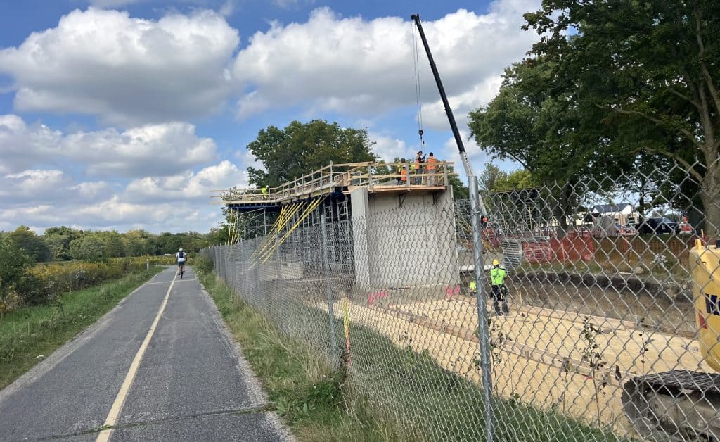

The bridge from the Busse Woods Forest Preserve to a new Elk Grove Village development is taking shape, with a truss over Arlington Heights Road put in place Oct. 14. The Daily Herald captured the installation with cool drone pictures.
Elk Grove Village leaders, with support from residents, decided to build the bike-pedestrian bridge to connect to The Vue, a development with rowhomes and apartments plus stores that’s also taking shape. The new bridge is costing $9.3 million, according to village documents, well above the cost of other suburban bridges. It’s expected to be completed in the spring of 2026, the public works department says.
The bridge, just a block south of the intersection with Higgins Road, is viewed as a safer way for Elk Grove residents to access Busse Woods and its trails, as people often jaywalk across Arlington Heights Road now to reach a sidepath. The bridge also provides a safer way to ride out of Busse Woods into Elk Grove Village and ultimately DuPage County if desired.

PBS documentary features Illinois Prairie Path
PBS is airing the documentary “From Rails to Trails” online and did on TV. The hourlong film, adapted from a book, is about the nationwide rails-to-trails movement that really got its start in our Chicago suburbs.
As the Rails to Trails Conservancy wrote, the film features May Watts’ transformative 1963 Chicago Tribune letter to the editor advocating for what would become the Illinois Prairie Path. It was a time, she wrote, when “many bulldozers are drooling” to develop the former railway in that space. Watts’ shared vision of a walk among the nature that surrounded the abandoned rail line served as a tipping point, drawing a groundswell of public support.
Her call to action and the resulting Illinois Prairie Path was an early, signature victory for trail advocates, the Conservancy wrote, and it ignited the rails-to-trails movement. Alas, as the film notes, The Elroy-Sparta Trail in Wisconsin edged out the Prairie Path as the first rail-to-trail to actually be completed, because that rural trail had far fewer land-ownership issues to navigate.
The documentary aired on PBS Oct. 15-26. The film can be seen at anytime, without any registration or fee, at www.pbs.org/show/from-rails-to-trails. Here’s the trailer.
For Prairie Path-related events, visit ipp.org/events/
Schaumburg shows latest Braintree Drive plans, with off-road path
Updated Sept. 10: An 8-foot off-road path was included in the latest plans for Braintree Drive that the Village of Schaumburg presented at an open house Sept. 10.
A controversial “compact roundabout” is also planned at Weathersfield Way, but that was not part of the Sept. 10 open house; it had been part of previous public meetings.
The latest open house was about resurfacing Braintree from Bode Road south to just north of Weathersfield Way; that makes up two out of three segments of the Braintree project. Parking would be added on both sides of the road and residents’ aprons rebuilt. Diagrams are available online, and feedback was taken through Sept. 24.
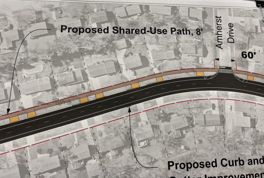
The sidepath would be built off the west side of the road in place of the existing sidewalk. The off-road path is now proposed to be 8 feet wide, as opposed to 10, to reduce the number of trees that would have to be removed. A similar move was made on Salem Drive this year.
The overall plans involve improving Braintree Drive from Bode Road all the way south to Wise Road. Construction on the northern two segments, between Bode and almost Weathersfield, is scheduled to begin in the spring of 2026 and last into the fall.
The segment from the roundabout at Weathersfield to Wise Road involves fully rebuilding Braintree Drive. That work is also scheduled to begin next spring but last into 2027.
All of Braintree now has 4-foot bike lanes, but those would be removed in favor of the sidepath — in keeping with a village trend in which residents are said to prefer bike paths off the street, for safety’s sake. But some residents object to the sidepath crossing their driveways, for fear they won’t see bicyclists, scooter riders and others speeding on the path.
The village didn’t say how exactly it’s taking feedback except with a “comment form” provided in the exhibit; there’s no online portal for comments only about the Braintree project. The village does have an online form for general comments.
Earlier, the village decided to go forward with the roundabout at Weathersfield even though many residents in the area, 13 out of the 17 who submitted comments, objected to it, out of concern drivers wouldn’t stop for pedestrians, according to the village. One out of the 17 residents supported it. More than 170 letters about the project had been mailed to residents.
“Pedestrians and bicyclists retain the right-of-way and motorists must yield to them before proceeding through the roundabout,” the village said in a September 2024 recommendation. It argued that roundabouts slow motorists, allowing more reaction time for pedestrians, and that roundabouts make pedestrians have to look for drivers in only one direction, not all directions as at four-way stops. The village also cited the success of roundabouts in Gurnee and Crystal Lake neighborhoods, with no crashes involving bicyclists or pedestrians.
Schaumburg plans more off-road path on Weathersfield Way
The Schaumburg village board on Sept. 23 decided to continued the village’s shift from bike lanes to off-road paths by hiring an engineer for an update to 1.35 miles of Weathersfield Way that includes a multi-use path on one side.
An 8-foot-wide concrete path would replace a sidewalk as part of plans to resurface Weathersfield Way from Barrington Road on the west to Springinsguth Road on the east. A path already exists on the north side of the street from Barrington to just west of Knollwood Road, but 4-foot-wide bike lanes run down both sides of the street down to Braintree Drive.
Weathersfield Way is about a 3-mile-long, two-lane east-west neighborhood throughway in southwest Schaumburg. Some contend the 4-foot-wide lanes on the sides are not even legal bike lanes. The lanes are dotted with cracks and potholes in any case.
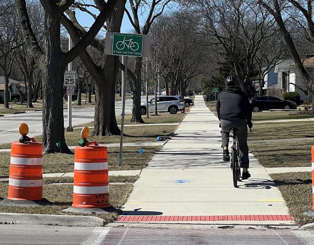
About a half-mile stretch of Weathersfield was recently resurfaced to the east, between Braintree and Salem drives, with the bike lanes removed, parking lanes added and an off-road path built on the north side. East of Salem Drive, bike lanes and the older surface resume down to Plum Grove Road.
No parking lanes are in the new plans so far for the west end of Weathersfield. Some intersection and crosswalk evaluations are in the plans. Which side of the street the new path would be built also is to be evaluated.
The project timeline includes a public feedback period in April 2026. Construction isn’t expected until the spring of 2027.
The work extends to a controversial planned roundabout at the intersection with Springinsguth Road (below); that’s not expected to be built until at least 2028.
Rolling Meadows spikes Kirchoff Road lane reduction, bike lanes
Updated Sept. 10: The Rolling Meadows City Council on Sept. 9 rejected a lane reduction and bike lanes on Kirchoff Road through a central part of the city. The vote was 4-3, according to Alderperson Kevin O’Brien.
Rolling Meadows leaders were considering updating its comprehensive plan with improvements to a milelong stretch of Kirchoff Road — to reduce it to two lanes but add a center turn lane and bike lanes in order to slow traffic through what they hope would become a more vibrant downtown, the Daily Herald reported.
The current outermost lanes of traffic would have been turned into parking spaces west of Meadow Drive, while protected bike lanes would have been built off the curbs. East of Meadow Drive, instead of parking, parkways in front of the houses would have been expanded.
Engineers believed the changes could reduce the frequency of crashes involving vehicles, bicycles and pedestrians, and give schoolchildren a smaller street to cross.
The city council on March 25 decided to hold off on making the 110-page Kirchoff Road Corridor Study part of the city’s comprehensive plan, after hearing businesses’ concerns about the loss of traffic in the corridor. Residents continued to speak up against it, including with an online petition said to garner more than 1,500 signatures.
The city’s Planning and Zoning Commission on March 4 was divided 3-3 on the study’s transportation component, which includes the lane reduction and bike lanes. But on Sept. 2, the panel in a 5-2 vote approved the study with the lane reduction and bike lanes, but without the parking provisions.
Springinsguth Road bike path plan to change near roundabout
Updated Aug. 19: Schaumburg Mayor Tom Dailly on Aug. 19 railed against the plan to reduce Springinsguth Road from four lanes to two and add a roundabout at Weathersfield Way, but he, the village board and administrators agreed they could change a bike path’s route in the plan.
The village board on Aug. 12 had approved the first phase of the plan to reduce about a mile and a half of Springinsguth Road to two lanes of traffic, plus a center turn lane, and add the roundabout. But the mayor called for further village board discussion a week later about a planned off-road bike path’s shift from the west side to the east side north of Weathersfield, away from an elementary school.
At the board’s Aug. 19 meeting, Dailly suddenly criticized the whole Springinsguth plan.
“I think reducing this from four to two is an issue,” he said. With speed cited as one of the problems on Springinsguth Road, “maybe we just need to do a little bit better enforcement to get people to slow down.”
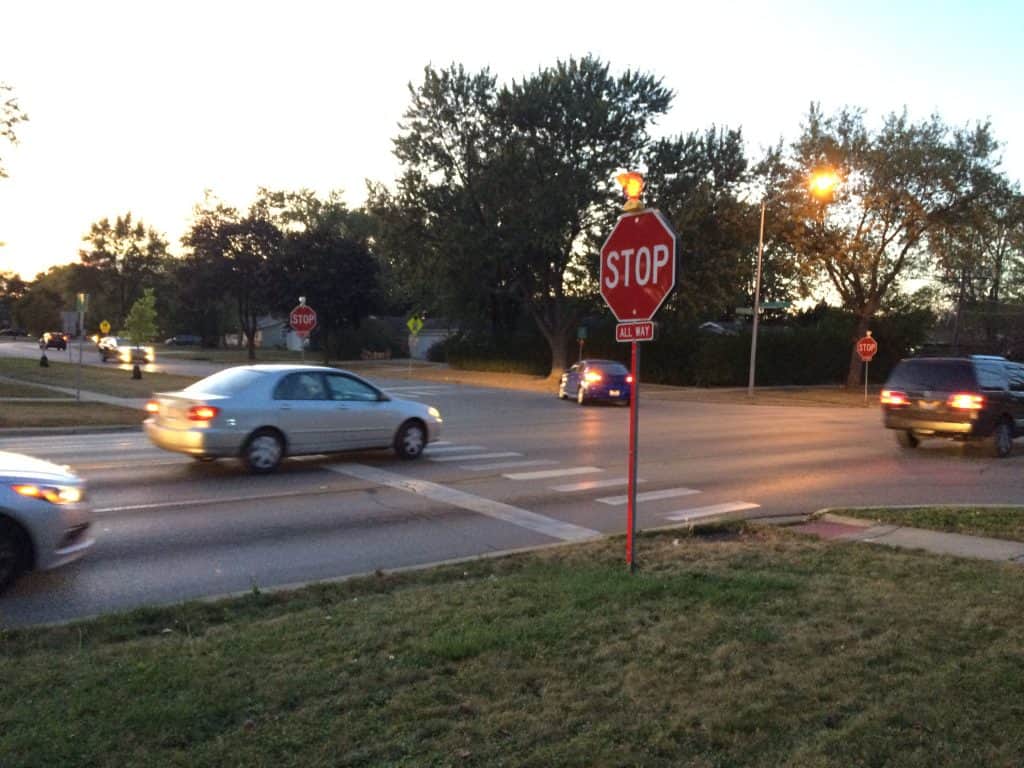
Dailly admitted not liking roundabouts. He said he didn’t think one at the Springinsguth-Weathersfield intersection would be the safest option for pedestrians and bicyclists, especially with Campanelli Elementary School nearby.
“I think a mother with a stroller is going to have more difficulty crossing a roundabout than she will at a four-way stop,” he said.
But Dailly turned to the trustees for their input, and all but one disagreed with him.
“It’s like a highway. A four-lane (road) just causes high-speed traffic,” Trustee Mark Madej said. And he cited statistics that show fewer crashes at roundabouts than at stop signs or traffic lights. “It’s a fact. We’re not talking about in theory.”
Trustee Esha Patel cited the changing nature of traffic, especially distracted drivers, in supporting the lane reduction to slow traffic. Trustee Brian Bieschke cited evidence of drivers speeding 25 mph above the 30 mph speed limit, and he also noted the roundabout statistics. “The facts are the facts: Roundabouts are safer for pedestrians and bicyclists,” he said.
Trustee Jack Sullivan agreed with the mayor. Two residents also spoke up against the whole Springinsguth plan. In the end, the full board informally agreed to keep the lane reduction and roundabout plans intact.
But all the trustees agreed on updating the bike path plans to keep it all on the west side between Wise and Schaumburg roads, as long as separately planned utility line burial in about the same place could happen at the same time and the Springinsguth Road project won’t be delayed. Construction is not planned until 2028 or 2029.

The new section of Springinsguth would have parking and bumpouts on much of the east side. The bike path’s shift to the east side north of Weathersfield led to one resident on Aug. 12 to ask the village board to remove either the parking or the bike path in front of her and four neighbors’ homes. They feared a risk of crashing into other drivers or bicyclists, especially speeding e-bicyclists, as they enter and exit their driveways because of reduced visibility.
Underground utilities and tree loss had been cited as reasons the bike path couldn’t be built on the west side. Continuity with a bike path now on the east side of Springinsguth north of Schaumburg Road also was cited. But the village leaders said there could be a way to accommodate both the bike path and the utilities on the west side.
Engineers, planners and village staff members first presented the latest plans at an open house June 18, recommending the roundabout among three alternatives for the Weathersfield intersection. The other options were traffic lights, or stop signs as there now.
Comments were taken at the open house as well as online via a web page and map, and by email, until July 4. Of the 40 comments that mentioned a roundabout, 18 favored it and 17 opposed it, while 5 were indifferent, the village said. This Transportation Committee meeting packet provides more details. The committee advanced the plans Aug. 5.
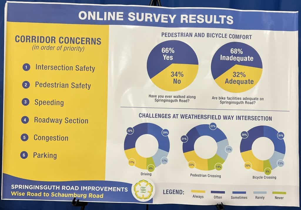
Comments on social media have shown a wide range of views, many skeptical of roundabouts, many saying “just put a traffic light there,” and many backing the roundabout.
On lane reductions, the planners have touted statistics saying they reduce crashes 19% to 47%, including those leading to injuries or deaths, and particularly rear-end and left-turn crashes. They cite the lower speeds and dedicated bicycle infrastructure such as bike lanes — though the Springinsguth plans retain off-road paths instead of bike lanes, a pattern seen elsewhere in the village.
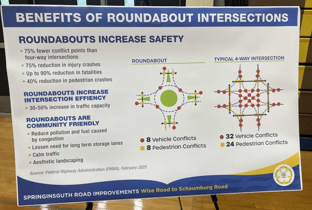
After the village’s first open house about the Springinsguth Road project March 13, the majority of 16 comments favored a roundabout, though with some safety and functionality concerns, the village said. Seven comments favored lane reduction with parking, and they emphasized bicyclist safety.
Schaumburg has a couple of roundabouts already, though they’re in the industrial part of town. A new roundabout is planned to come about a half mile east of the Springsinguth-Weathersfield intersection, at Braintree Drive and Weathersfield, in 2026. Village administrators say the Springinsguth roundabout is a “compact” one that would be a little larger than the Braintree roundabout.
The Springinsguth Road project now moves to Phase 2, with more detailed engineering and designs to be done.
Disclaimer: I, the author, am a Springinsguth Road resident.
Latest Fairfield Road plans in Lake County
The Lake County Division of Transportation is continuing to study potential improvements on Fairfield Road from Rollins Road to Monaville Road in unincorporated Avon Township, unincorporated Lake Villa, and Round Lake Heights. It held a new feedback period that ended Aug. 15.
The county says improvements are anticipated to include widening existing shoulders, and “non-motorized improvements are being evaluated along Fairfield Road from Rollins Road to Monaville Road, and along Monaville Road from Fairfield Road to the Grant Woods trail underpass.” Installing such paths might require acquiring certain property rights.
The project originally was being considered from Gilmer Road north to Oakwood Drive in Round Lake Beach; the last open house happened on June 16. Preliminary planning and environmental studies began in 2024, and options included turning Fairfield into a 3-, 4- or 5-lane road. It appears the engineers now are sticking with two lanes of auto traffic and an off-road path.
Two poll questions on the project website at one time asked specifically if residents would prefer a sidewalk, an off-road path, bike lanes, paved shoulders or nothing new.
We’re nowhere near construction, but the plans could make safer bicycling connections between Wauconda and Round Lake Beach, and four forest preserves.
Updated definition of ‘bicycle’ in state law
Legislation updating the definition of “bicycle” in the Illinois Vehicle Code to allow for more than two wheels was passed in May by both the state House and Senate. The bill introduced by Sen. Mike Simmons and Rep. Lilian Jiménez, with lobbying from Ride Illinois, updates the definition to include devices such as tricycles and adaptive bikes so that they’re allowed on roads where bicycles are allowed. The move aligns with legislation in other Midwest states.
Richmond adopts a bike-ped plan
The Village of Richmond, just south of the Wisconsin border, in the spring published its 90-page Bicycle and Pedestrian Plan after spending a year or so surveying and talking to residents. The recommendations include 33 miles of new bicycling infrastructure that strongly favors new off-road paths — 17 of those miles. Another 13.5 would be other trails. About 4 would be “bicycle boulevards,” or low-speed streets prioritizing bicycling. The sidepaths along would cost $29 million, so implementing the plan is still to come.
Public engagement was a huge part of the plan, with three phases devoted to it since February 2024. U.S. Route 12 crossings were an important theme, and another was overall safer biker conditions and the desire to be able to bike more. One person who lived just outside Richmond said they wanted better bike connections into the village, the village’s document says.
Lake County moving on Route 53 greenway?
The Lake County Forest Preserves’ board president said April 24 that the agency wants control of the corridor of land set aside for the abandoned Route 53 extension so it can manage it itself. Jessica Vealitzek, elected in December 2024, announced that the agency “has initiated talks with the State of Illinois to transfer 1,005 acres of land tied to the former Route 53 Corridor into its care.”
“Our vision is to preserve this land as open space and eventually develop multi-use trails,” Vealitzek said. “The trails are essential to improve connections in the southwest part of the county and link the Millennium Trail in the central region. … The Forest Preserves is the ideal steward for this land.”
The state has made moves to seriously look at turning the corridor into a greenway, complete with a 12-mile trail. Gov. J.B. Pritzker’s budget allocated $1 million to start planning the greenway. The money was ultimately included in the Illinois Department of Natural Resources’ budget for “developing a land-use master plan for Route 53 expansion land,” the Daily Herald reported. The Illinois Route 53 Expansion Land Alternative Use Task Force, to which the Lake County board was one of many agencies contributing, advocated for the creation of the greenway and the transfer of the land from the Illinois Department of Transportation to the Illinois Department of Natural Resources.
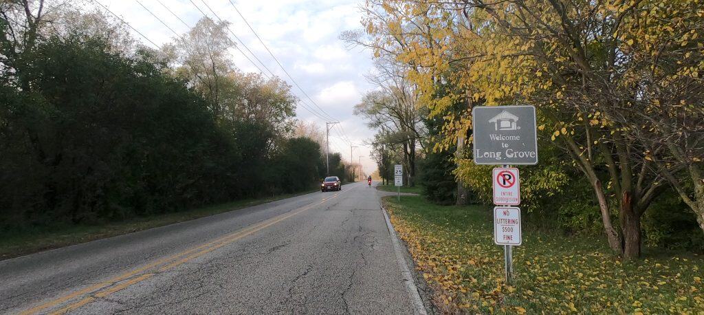
IDOT still owns the corridor, even if the IDNR is leading the planning for it. IDOT gave the Daily Herald the exact same statement it’s given the paper and NBC 5 Chicago in reports going back to June 2024: “IDOT looks forward to continuing the work with IDNR and our local partners to determine next steps regarding any transfer of land,” IDOT spokesperson Maria Castaneda said.
The IDNR gave the Daily Herald a little more, addressing the idea of the Lake County Forest Preserves taking over: “This is an option that’s on the table as long as all Route 53 task force members and stakeholders agree that it’s the best course of action,” spokesperson Jayette Bolinski said.
“There is a long road ahead, and we need to have many more conversations with our colleagues at the State,” Vealitzek said, “but we are excited to move forward.”
Here’s more of what’s been recommended for the corridor.
Hearings on an Oakton Street path in Niles
“We invite you to see the future of cycling and pedestrian experiences in our community,” a flyer said about a meeting April 30 in Niles about a new bike-pedestrian path along Oakton Street from Waukegan Road to Caldwell Avenue. “As part of the Niles Bicycle & Pedestrian Plan, these upgrades will improve safety for all people using the road and are essential to creating a safer, more accessible, and enjoyable environment for cyclists and pedestrians.”
The project’s first design phase is being finished this year; more detailed design and finally construction come later, TBD. A similar project is in the works (with the same “future of cycling and pedestrian experiences” idea) on Shermer Road between Waukegan Road and Dempster Street — though it’s bike lanes planned there. Niles is working with Morton Grove on the plan, as Shermer “was selected as a potential regional trail connecting the communities of Niles, Morton Grove and Glenview,” Niles’ page on the project says. Construction is expected in 2026.
Niles also plans to improve bicycle accommodations at Waukegan Road and Cleveland Street to better connect to the North Branch Trail, the village says. An open house on that happened May 27.
Staffers teach rules on Cook County trails
The staff of the Forest Preserves of Cook County was getting out through Sept. 20 to meet people on trails. “To raise awareness about trail rules and etiquette, Forest Preserves staff will set up Share the Trail rest stops on the trails from May through September to talk about how the dogwalkers, bicyclists, families, runners, walkers and even horseback riders can be on the trail in a way that makes the experience great for everyone,” the agency posted.
The stops were set up at a new spot on the first and third Saturdays of the month. Teaching users the rules is part of the goal. “A big part of Share the Trail is reminding people to stay on designated trails, avoid using motorized or electric vehicles aside from Class 1 & 2 e-bikes, and encouraging awareness of trail rules and etiquette,” the post says. That includes speed limits. Read more from the county.
2025 Illinois Bike & Walk Summit
The venue for Ride Illinois’ 2025 Illinois Bike & Walk Summit May 7-8 in Springfield was abruptly changed due to vandalism at the original conference site. The summit wound up at the Bank of Springfield Center. It’s impressive that a new venue could be secured only a month out.
The keynote speaker was Tom Flood, a communications professional who focused on “Reframing Road Safety.” Flood has written, given lectures and run workshops that focus on reframing the mainstream narrative around road safety, road violence and active transportation, and highlighting the imbalance on our streets.
The first day was full of speakers and breakout sessions, concluding with a happy hour in the evening, while the second day featured advocate and technical training, a trail development workshop and a “lobby day” that entailed an afternoon of visits with lawmakers. Chicago suburbanites were among the presenters. See the key takeaways.
Lake County construction: Old McHenry Road
Lake County announced its 2025 road construction program, and among the projects notable for bicyclists is the repaving of Old McHenry Road from Cuba Road to around Quentin Road. Old McHenry Road is a favorite road ride for serious cyclists because it’s pretty and fairly lightly trafficked (until the Hawthorn Woods area at least). The Darrell Road roundabouts also are on the list. The county also notes that non-motorized paths are a big part of its short- and long-term construction plans; it has an interactive map showing those.
I&M Canal bike ‘Gateway’ in Channahon
Groundbreaking began March 18 on what the Village of Channahon is calling the I&M Canal Gateway, at 25450 W. Eames St. The hub with parking and bike facilities will come about 9 miles west of the I&M Canal Trail‘s eastern start in Rockdale. The Gateway will include a bike rental facility, bicycle repair stations, bike racks, a water fountain, a water bottle filling station, a pavilion with seating and, eventually, public art. The parking area will be constructed of permeable pavers. Construction is scheduled to be finished by the summer.
In Batavia: Bike/ped ramp to Peace Bridge
The City of Batavia said it is moving forward with a ramp up to Peace Bridge from the lower Fox River Trail on the east side of the river, allowing bicyclists to ride up to the bridge rather than climb stairs to get to it. The ADA-compliant ramp will be built by the parking lot near River and State streets. Work is scheduled to take place throughout the summer and fall. Crossing the Peace Bridge gets you to the Batavia Riverwalk, which circulates around a peninsula in the middle of the river, as well as to the Fox River Trail along the west bank of the river that can take you north to the Fabyan Forest Preserve.
llinois Prairie Path updates
- The annual clean-up of the Illinois Prairie Path was April 26.
- The DuPage County Division of Transportation says it spent almost 9,000 hours last year on trail maintenance, which includes mowing, graffiti removal, storm clean-up, invasive species removal and responding to residents’ concerns. It’s looking ahead at future projects like a wayfinding and signage plan.
- Cook County notes Prairie Path improvements on its side of the border, such as new pavement from 1st Avenue to Mannheim Road and new trees being planted. It also says plans to extend the path to Forest Park and the CTA Blue line, which have been in the works since at least 2022, are in the design/engineering study phase.
- The Illinois Prairie Path Winter 2025 newsletter is posted among the newsletter archives.
There was a clean-up also April 26 for the Great Western Trails, from Sycamore to Villa Park. Various groups volunteeered, like out of West Chicago and Campton Hills. The Friends of the Great Western Trail have more information. And Ralph Banasiak writes more about the efforts in his Daily Herald column.
Russell Road roundabouts with bike shoulders
Lake County says about a half mile of Russell Road will be improved in 2026 with roundabouts at Kenosha Road and Lewis Avenue. The single-lane roundabouts will include 4-foot bike-friendly shoulders on the repaved road between the roundabouts. In preparation, crews are out this year doing work such as relocating utilities and clearing trees. The project has been in the works since 2019, with the last public hearings on it in October 2021. Crashes were cited as a reason to add the roundabouts.
Old Plank Road Trail extension
The final report of the Old Plank Road Trail Feasibility Study was published in January 2025. The Old Plank Trail already is a 22-mile paved trail in Cook and Will counties, and now plans call for extending it about 10 miles to connect to the Pennsy Greenway in Schererville, Indiana.

It would use an inactive rail corridor that goes through Chicago Heights, Sauk Village and Lynwood in Illinois, then Dyer and Schererville in Indiana. It could also connect in Griffith, Indiana, to the Erie Lackawanna Trail and C&O Greenway.
The study began in 2022 and recently concluded with public engagement events as well as conversations with local governments. The Active Transportation Alliance reports on it.
• Do you find up-to-date information valuable? Consider donating to help defray the costs of this website.
Illinois is just pathetic when it comes to proper road infrastructure. Two great examples exist — Rt. 12 in Wisconsin is a 4 lane freeway while south of the Illinois border – 2 lanes — same thing with Green Bay rd. — 2 lanes south of the border, but 4 and 6 lanes in dairyland. Go find a map of the 53 alternatives from like 2010 or earlier and we were supposed to end up with a network of 4 and 6 lanes roads if 53 wasn’t going to get built. Fairfield, 22, Midlothian, and 60 all still have WAY TOO MUCH 2 lane sections where they should have been widened to 4 at least a decade ago. An intersection like Fairfield at 60 ROUTINELY backs up a third of a mile during PM rush partly because they can’t even build right turn lanes to max the flow of thru traffic while drivers have the green.
Roundabouts slow down emergency vehicles. Please take that into consideration.
Sharon, a 2020 study by Kimley-Horn of 323 first responders found that 68% of respondents found traffic circles to be beneficial for emergency vehicles response due to better traffic flow and fewer overall accidents in the community.
Your blanket statement that roundabouts slow down emergency vehicles isn’t true in all cases, since without traffic preemption devices, emergency vehicles might need to stop completely before entering an intersection. It also doesn’t seem to balance the other benefits that roundabouts provide over conventional intersections.
I believe that many communities would rather have fewer vehicle accidents and lower traffic congestion overall at intersections at the expense of 15 extra seconds of emergency response time.