
First published late April 2025. Most recent updates: Sept. 4, 2026: Glenview added; June 23: Downers Grove added; May 20: Aurora pictures and info on bike lanes added; March 24: Tweaks to south Cook suburbs and adding Blue Island; Feb. 3: Evanston updated again; Dec. 3, 2025, to update on Alsip, Aurora, Evanston, Northbrook, Naperville; Nov. 18 to add Mount Prospect plans; Oct. 15 to add Park Ridge; Oct. 13 to add to Bartlett, Oak Park.
My article on how the village of Schaumburg is shifting from bike lanes to off-street paths in a few neighborhood road construction projects generated plenty of discussion among Schaumburg residents.
Village leaders decided to go with off-street paths in place of bike lanes on recent or ongoing projects that include Walnut Lane, Weathersfield Way and Salem Road reconstruction. After a little back-and-forth, they decided it was safer for riders, especially families, to be off the street rather than be separated from possibly speedy traffic only by a white line.
The streets in question are sidestreets in the village, though they’re kind of main thoroughfares within neighborhoods. Many streets in the village have had bike lanes for decades — 4 feet wide with only a painted stripe, no further infrastructure like medians or bollards as seen in cities.
The village also had made use of off-road paths on busier streets, such as on Roselle Road, Plum Grove Road, Meacham Road, Wise Road and more recently even Golf Road. All the lanes and paths have burnished Schaumburg’s reputation as bike-friendly.
Looking extensively at what other suburbs do, I find that a mix of on-street bike routes and off-road paths is not uncommon, though actual marked bike lanes are less common. That’s if suburbs have a bike route system at all — many are only now just establishing them, while others made a plan a decade ago or more and appear to have let it languish.
Schaumburg residents’ reactions
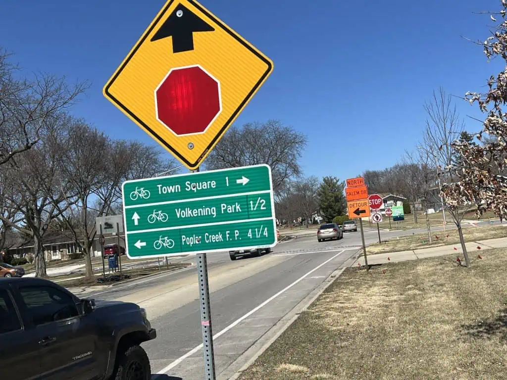
The shift from neighborhood bike lanes to off-street paths garners both praise and skepticism from residents. Some agree that it’s safer to keep bicyclists off the street. Others worry that the multi-use paths, at 8 or 10 feet wide and only on one side of the street, will be too busy themselves with walkers, pets, skaters, bicyclists and even e-bicyclists, and possibly still be dangerous.
Certainly the paths are not great options for faster cyclists who may intimidate others. To which some say such serious cyclists will stay on the road anyway, as they’re probably more comfortable in traffic — even if the traffic is not so comfortable with them. New infrastructure such as bump-outs, as were installed on a stretch of Walnut Lane, could complicate serious cyclists’ journeys further, even as they make it safer for pedestrians to cross the street.
Some argue that the 4-foot bike lanes that the village does have are inadequate anyway. It’s only a painted white line close to the curb, they say, and often the lanes are filled with debris or in disrepair. All in all, the village is left with trying to strike a balance among competing needs and views.
Looking at other suburbs
So what do other suburbs do? My experience riding through many of them, and seeing the systems or plans municipalities tout, shows a wide range of infrastructure. Some towns have only “Bike Route” signs with arrows. Some do use paths widely. Bike lanes through suburban neighborhoods frankly aren’t the norm. Some towns have no plans or are just starting them.
Here’s how it looks suburb by suburb. Please correct me where I’m wrong about your area, or tell me about your suburb if I don’t have it listed. Click on a bullet line here to jump to a region.
- East Cook suburbs
- West Cook suburbs
- South Cook suburbs
- North DuPage
- South Fox Valley
- South DuPage
- North Shore
- Lake County
- McHenry County
East Cook suburbs
Arlington Heights — mostly signage
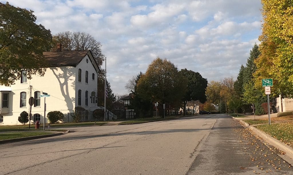
The long north-south village has a bike route that can get you across its full length (about a dozen miles), and there are east-west routes. You just have to follow the signs — and I have to admit, it took me several tries to follow them all the away from the southern to the northern border. “Arlington Heights has established bike trails throughout the community,” a village web page says, but I think “routes” would be more accurate in place of “trails,” because there are no bike lanes and few paths. Most streets on the route are wide, especially the neighborhood thoroughfare Kennicott Avenue/Blvd./Drive, so there’s usually plenty of room for bicyclists. Still, it looks like from the village’s bike route map that more “on-street bike routes” and “off-street bike routes” are planned.
Elk Grove Village
Encouraged for years by a mayor who’s been an avid cyclist, Elk Grove has created and updated a bicycle plan over the last decade. Its 2022 update shows a map outlining a mix of on-street bike routes, off-road paths, “alternate routes,” and many more proposed bike routes. Signs on some streets steer you through the routes. It doesn’t hurt that the Busse Woods forest preserve and trail is at the center of it all.
Rolling Meadows — paths in town
There are not too many neighborhood bicycling throughways among Rolling Meadows’ narrow, curvy streets, with the exception of the more straight Campbell Street, but there are significant off-road paths to help get around town, like off Euclid Avenue and Rohlwing Road, then off Kirchoff Road. Mostly connected trails also run through North and South Salk parks and Kimball Hill Park. City leaders were talking about bike lanes through downtown but ultimately rejected them. Now I hear they’re working on a bicycle and pedestrian plan in 2026.
Mount Prospect — shared bike lanes and sharrows
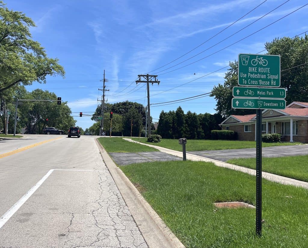
The village says 28 miles of “on-street bike routes” have been installed since 2012, in Phase 1 of its Bicycle Plan that it adopted that year. Those are shared parking/bike lanes, sharrows or just signage. It’s now studying how to add bicycling infrastructure to arterial roads through town; it released an “existing conditions report” in June 2024.
One result is a plan to build an 8-foot-wide path off the north side of all of Algonquin Road that runs through the village, about 1.7 miles. Another is a plan with Cook County to build an 8-foot-wide path as part of Busse Road reconstruction from Central to Golf roads, about 1.25 miles.
Construction on both projects is scheduled to begin in 2026 and conclude in 2027. A bigger development is a bike-pedestrian bridge over Northwest Highway/Route 14 scheduled to be built in 2026; it will connect Melas and Meadows parks.
Prospect Heights — a trail
Not a lot of throughways in small Prospect Heights, but it does have the Prospect Heights Trail across the north and through the center of town.
Des Plaines and Rosemont — on-street routes
The City of Des Plaines is slowly improving its bicycling network, particularly in conjunction with the nearby Des Plaines River Trail. The city touts 15 miles of on-street routes and more than 5 miles of “shared lane markings or other supportive pavement markings,” plus a few off-road paths. It’s working on an “Active Transportation Plan” this year for further improvements. Improvements have been made, too, in Rosemont especially in terms of accessing forest preserves like Catherine Chevalier Woods from River Road via paths.
Park Ridge — keeping bikes on streets
Park Ridge in 2018 updated its official Bike Plan, first created in 2005, with the help of a Bike Task Force as well as Ride Illinois and the Active Transportation Alliance. It suggests adding bike facilities throughout the city but emphasizes on-street bicycling rather than off-road paths.

The pinnacle of the plan so far is the “Busse Highway Road Diet,” which got done in 2025; it took more than seven years in large part because it was actually an IDOT project that the city had to influence. Once a four-lane road with parking, it now has one lane for auto traffic in each direction, a center turn lane, and a bike lane in each direction separated from the curbside parking by a painted 2-foot buffer.
Park Ridge otherwise has a few bike lanes marked by simple painted lines off the curbs, or streets with sharrows, or on-street bike routes simply noted by signs. The city has an online map that’s not helpful in determining which facility you’ll find where, even when more detailed maps had been made for the Bike Plan document. That document in any case is explicit about favoring bicycling on streets, not sidepaths.
“Due to the fear of getting hit by a car from behind, many believe sidepaths or sidewalks are always safer than on-road bicycling,” the document says in one section. “Surprisingly, this is not the case where there are many side streets, residential driveways, and commercial entrances — especially for ‘contra-flow’ cyclists biking against the flow of traffic.” “Only in special cases should sidepaths be recommended where there are too many crossing conflicts (driveways, entrances, cross streets) or where residential front yards will be impacted,” it adds in a list of guidelines. And the Bike Plan lists ways to make sidepaths safer, such as refuge islands within intersections and keeping paths actually closer to the road so drivers who may be turning will more easily see bicyclists coming.
The Bike Plan then goes into detail on various on-street bicycling facility options, from the sharrows to protected bike lanes. Busse Highway notwithstanding, the word is that citywide implementation is slow going.
Niles

Niles’ bike route map shows a single bike route: Robert Amling’s Memorial Bike Route. The village has a few more bicycling facilities, like sharrows (even in a green painted box) on many streets, as well as a protected bike lane on Howard Street, which intersects (with flashing beacons) with the North Branch Trail. Niles is working on a lot more. Its 2022 update to the village’s Bicycle and Pedestrian Plan recommended 7.3 miles of new shared-use paths and 10.2 miles of new on-street bicycle facilities that include bike lanes, buffered bike lanes, more shared lanes and one more street with protected bike lanes. New bike lanes on Shermer Road and a path along Oakton Street are a couple of the latest results.
Buffalo Grove — paths and sidewalks
Buffalo Grove can be difficult to get through on streets, but the village touts “43 miles of paths and sidewalks.” “Pedestrians and bicyclists can enjoy this network of 8-foot paths and sidewalks,” a village web page says. That includes one along main thoroughfare Buffalo Grove Road; how good that is I don’t know. And there’s one on the southern border along Lake-Cook Road.
Long Grove and Long Grove Road
The little village of Long Grove (really over the Lake County border) is nice to ride through even if there’s no real bicycling infrastructure. There’s no signage or paths along what you might call its back roads like Checker Road, nor on neighborhood streets, nor on main roads like Old McHenry. The neighborhood streets are plenty comfy to ride, and the village does border the Buffalo Creek preserve and its gravel trails. Old McHenry Road is a really nice one for more serious cyclists.
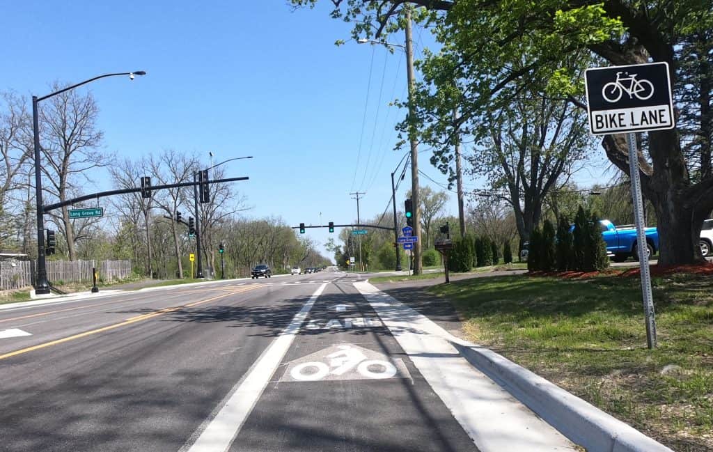
From the west, you can ride Long Grove Road and its wide bike lane through Deer Park and Kildeer, but the bike lane disappears once you get into Long Grove limits, and the road is a little tight but largely quiet.
Wheeling — a little happening?
A comprehensive Active Transportation Plan was created for Wheeling in 2012, but the web page on the village’s Bicycle & Pedestrian Task Force doesn’t appear to have been updated since. Not even Google Maps labels any streets bike-friendly, except for an off-road path along some of Dundee Road. But the village did request state funding for an 8-foot off-road path on Wheeling Road between Palatine and Dundee roads; the request was rejected.
Oak Park — bike lanes and more to come

Oak Park has been working to become a bike-friendly community since 2008, and it’s slowly made progress. There are bike lanes now, sometimes outside the parking spaces (so watch for dooring), on a few main roads like Madison Street and Harrison Street. Its updated bike plan in 2015 proposed “neighborhood greenways” with traffic-calming measures and key connections; many are now in place. And just in 2024 the village created a thorough, 53-page bike plan update, with drafts still being presented in 2025. It suggests a range of facilities like protected bike lanes, raised bike lanes, buffered bike lanes or just striped bike lanes. It sorts proposals into short-term, mid-term and long-term concepts.
Riverside and Brookfield
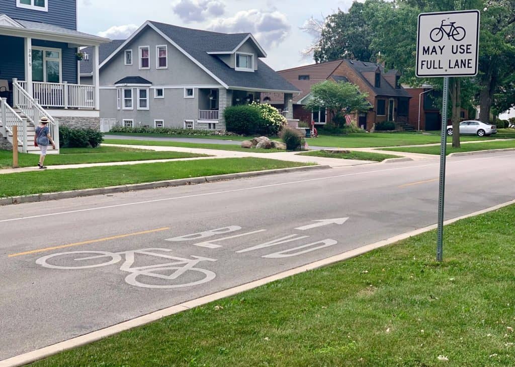
The neighboring villages of Riverside and Brookfield have been working to improve bicycling infrastructure, but it’s been a slow process buoyed particularly by residents and their bike clubs.

Brookfield adopted its first bike boulevard, where bicycles get priority on a street, in 2017, and that’s the year its Active Transportation Plan was published. In 2023, when it resurfaced some of Washington Avenue, it added a bike lane on both sides of the full length of Washington. But the Cycle Brookfield club still has among its list of things it supports “more and safer bike lanes and bike routes in Brookfield” and “more and better cycling connections to neighboring suburbs and Chicago.”
Riverside leaders are getting on board with accommodating bicyclists as a result of the efforts of the Ride Riverside club, founded by Valerie Kramer and Matt Schalles.
Kramer was named an advocate of the year by the Active Transportation Alliance, which noticed the popularity of the slow-roll bike rides she and her club have organized as well as Kramer’s Vision Zero effort to eliminate traffic deaths and injuries in the village. She and the club have lobbied village leaders and the community for infrastructure improvements, and the village is starting to follow through: It has budgeted $55,000 for the first quarter of 2026 toward a bike and pedestrian plan, the Riverside-Brookfield Landmark reported.
Bellwood, Berkeley, Broadview, Hillside, Westchester
The villages of Bellwood, Berkeley, Broadview, Hillside and Westchester have partnered with the Chicago Metropolitan Agency for Planning to develop the West Cook Bicycle and Pedestrian Plan (“west” meaning west of Chicago). Residents’ input is being collected and meetings are being planned.
West Cook suburbs
The Barringtons — some bike routes
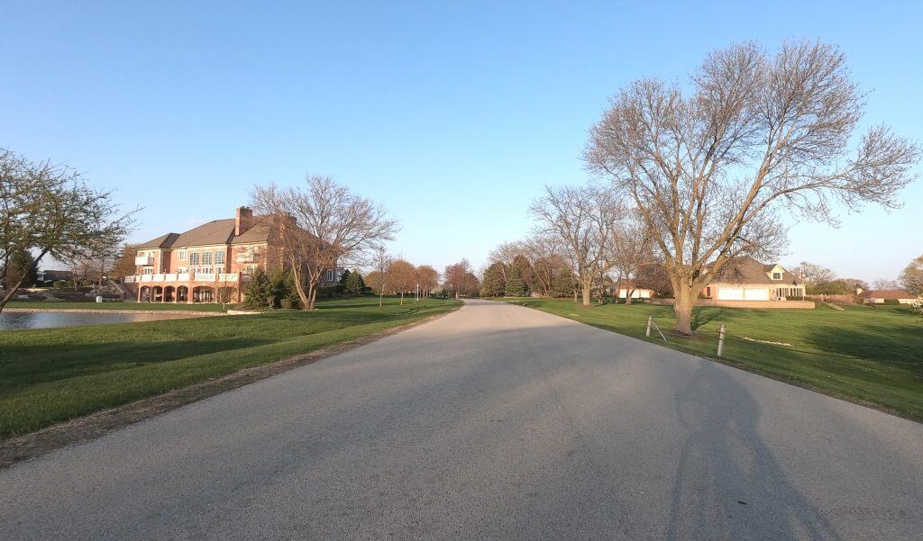
Similar to Wheeling, the village of Barrington created a Bicycle & Pedestrian Transportation Plan in 2012, and its web page on bikeways hasn’t been updated much since. But it does have some designated bike routes through town here and there, like along Dundee Avenue and Ela Road, and even a couple of bike lanes like along Hillside Road (if briefly). In the other Barringtons — Barrington Hills, North Barrington, Port Barrington, South Barrington — there are no bike routes per se, but many bicyclists ride on their pretty, often forested back roads. Barrington Hills leaders and residents often have clashed with bicyclists who ride on the narrow, beautiful roads, so riding single file there is imperative.
Palatine — bike or shared lanes

Palatine has a “Bicycle Transportation Plan” that it appears to have updated last in 2016, according to this thorough map and guide from the park district; 26 miles of bike routes are part of it, a village web page says. It calls for bike lanes or shared lanes in some spots. Illinois Avenue has both of those and more: The west end has a bike lane only on the north side of the road, going east the lane is briefly on both sides, and even farther east there’s an off-road path on the south side — until all options end.
In other places, only signs mark routes. They do help you navigate through town, but you often have to use your own wits, too. The Deer Grove Forest Preserve trails are nearby to the north, plus there’s the Palatine Trail that runs from just north of downtown and near Palatine High School to the east end of town; there’s an offshoot north to Deer Grove, too.
There’s also a trail (online in some places it seems it’s also called the Palatine Trail?) from the southwest side of town that connects to Harper College and is otherwise the safest way to get to Hoffman Estates and Schaumburg, and the Paul Douglas Forest Preserve trail.
Hoffman Estates — some bike lanes
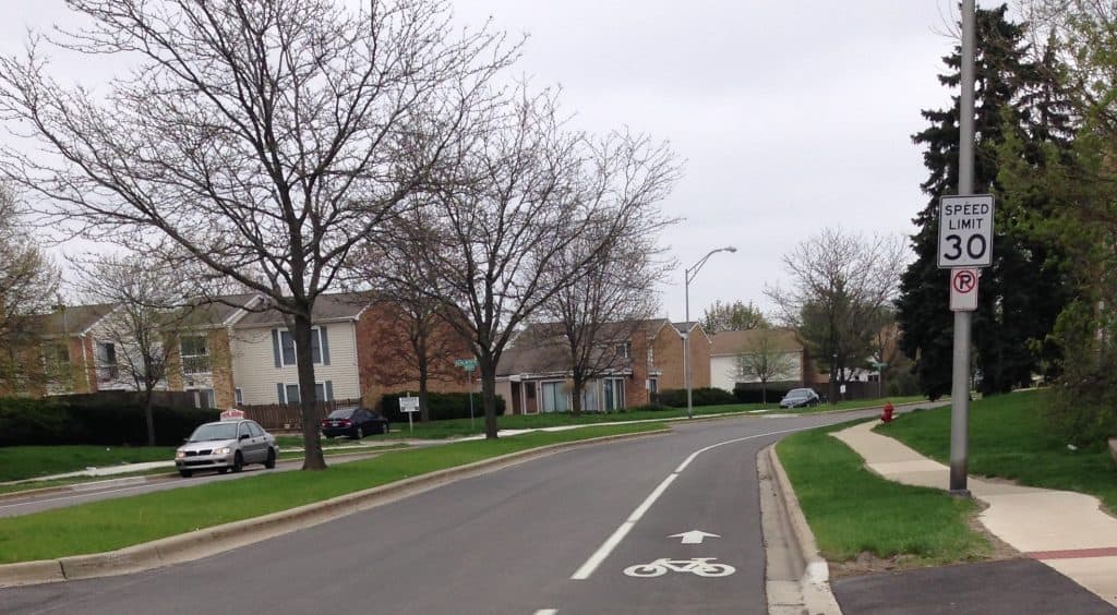
This suburb has worked to get bike-friendlier over the years by adding distinct bike lanes along many of its interior roads. Many years ago already, it turned four-lane Hassell Road, which goes by village hall, into a two-lane road with bike lanes on each side, outside the parking spaces (so watch for dooring). You can see more lanes on major neighborhood thoroughfares like Huntington Blvd. on both the north and south sides of town, and Moon Lake Blvd.
But you won’t see any on other main roads like Jones Road, Hillcrest Blvd. or Freeman Road. Nor do you see them on the newer west side of town. There is an off-road path along Shoe Factory Road west of Route 59, playing off the Poplar Creek Trail to the east. (It does not connect all the way through Elgin, though.) “The Village was recently awarded an Illinois Transportation Enhancement Program (ITEP) grant of $676,000 to construct an undercrossing of I-90, parallel to the CN railroad tracks on the west side,” the village’s transportation page says.
Bartlett, Hanover Park, Streamwood — many paths
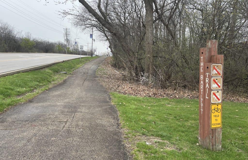
There’s a lot of excitement in the Tri-Villages, which are full of off-road paths and even a bike-pedestrian bridge in the works, in Streamwood (see pictures). Bartlett sports a network of off-road paths, in various conditions, along main thoroughfares like its Bartlett Roads (west and north) and Stearns Road, Devon Avenue and Newport Blvd., Struckman Blvd., and parts of Schick Road. They connect to forest preserves like Pratt’s Wayne Woods (if not quite all the way to James “Pate” Philip State Park) and Hawk Hollow Forest Preserve. The village also just built a two-way bike lane on the south side of North Avenue between Oak Avenue and Lake Street/Route 20.
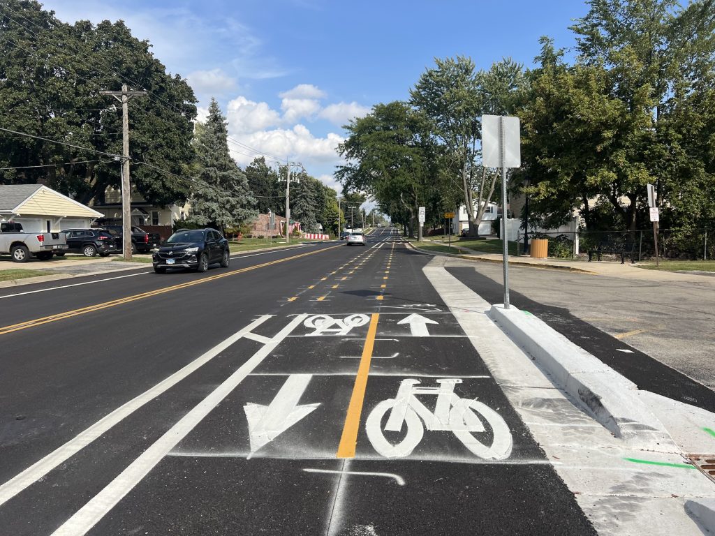
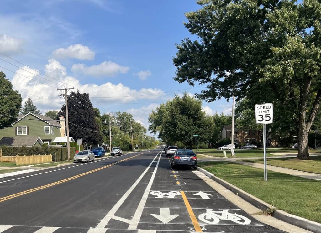
Streamwood has worked on bike trails through the center of town that the bridge over Route 59 will connect. There’s not signage or lanes or paths (to speak of), however, along throughways like Park Blvd. and Streamwood Blvd., though they’re not difficult to ride. Hanover Park has only a little bit of real bicycling infrastructure, such as the off-road path on its little section of Greenbrook Blvd. by Arlington Drive east to Route 20, and off-road paths, or basically wide sidewalks, along the retail area on Barrington Road.
Schaumburg — lanes and paths
See the top of this article! Note the village does have a League of American Bicyclists bike-friendly community designation.
South Cook suburbs
Palos area — trails everywhere
The Palos towns are surrounded by forest preserves with both paved and mountain biking trails — a huge hub for mountain biking lies to the northwest, and paved trails help bicyclists get around the towns and from preserve to preserve, too. A north-south trail runs from Palos Heights Community Park to Burr Oak Woods and the Tinley Creek Trail system, for instance. And there’s a greenway trail from Burr Oak to Orland Park. Nice east-west roads like 123rd Place across Palos Park and 127th Street between Palos Heights and Palos Park create at least unofficial bike routes.
Orland Park, Orland Hills, Tinley Park — trails
Without comment, the village of Orland Park provides a map and list of bicycling trails through the town or forest preserves, and extending into Orland Hills and Tinley Park. Orland Hills has the 88th Avenue Trail. Tinley Park has a north-south trail from north of Commissioner’s Park, past the Tinley Park White Water Canyon Water Park and through Volunteer Park.
Park Forest
The Village of Park Forest has “identified numerous opportunities to tie a local on-street network into regional trails and sidepaths,” according to the 2023 Cook County Bike Plan (page 29 of the PDF). Bike routes could link to the Old Plank Road Trail and Thorn Creek Trail system, for instance; the Old Plank runs through Park Forest and Thorn Creek right by it. Off-road paths are also planned.
Homewood
Homewood was another suburb cited in the 2023 Cook County Bike Plan (page 30 of the PDF) for “weaving together on-street, sidepath, and trail elements.” Bike routes could lead to paths through local parks, while off-road paths (now or in the future) along major roads can connect to nearby communities like Glenwood, which in turn can hook a rider to the Thorn Creek system.
Blue Island


The City of Blue Island’s website provides an online map to all the “Chicago Southland Trails,” notably the regional trails, but the city doesn’t tout its own bike plan. Yet it acknowledges and helps bicyclists ride through the center of town with buffered bike lanes and signage as part of the Cal-Sag Trail system.
Then it provides a closed-to-cars bridge over the Cal-Sag Canal at Chatham Street, and that leads to a path, recently paved and prominently labeled, that heads east along Canal Street to Whistler Woods. There’s a bike repair station off Canal Street, too.
Alsip
The Village of Alsip’s Bicycle & Pedestrian Plan web page link was broken in December 2025, but CMAP is touting it and the PDF is still available online. “Overall, the plan recommends 19.2 miles of new bicycle facilities,” the plan says. “These recommendations include 3.5 miles of bicycle boulevards, 1.5 miles of bike lanes, and 14.1 miles of shared use path.” CMAP also notes “better connections to regional assets like the Cal-Sag Trail,” which runs through Alsip.
North DuPage

Carol Stream — many off-road paths
It’s a small suburb, but Carol Stream has made use of off-road paths, either the ones it’s installed itself or those in the DuPage County forest preserves. It impressively has trails along the lengths of Fair Oaks Road, Lies Road and Kuhn Road. About half of the Lies trail on the east is nice and new, while the western half could use some love. The Fair Oaks trail is pretty nice the whole way and will hook you up to the Great Western Trail. There’s even a path along a little bit of Gary Avenue.

Glendale Heights — working on a plan
In conjunction with the Chicago Metropolitan Agency for Planning, a bicycle and pedestrian plan is in the works, with feedback being collected starting in 2024.
Glen Ellyn and Wheaton — bike routes
Glen Ellyn itself doesn’t label or publicize bike routes even though there are nice streets to ride, such as Crescent Blvd. or Hill Avenue, or around Lake Ellyn. Signs will point you to College of DuPage. As you go west into Wheaton, you’ll encounter signage, but no lanes or paths, for the “Wheaton Bicycle Network,” which takes you through downtown, past Wheaton College and the DuPage Event Center & Fairgrounds, and all the way to the DuPage County complex off County Farm Road. The city has had a Bicycle Plan since 2011, with no updates on its web page about it since then. Of course, the Illinois Prairie Path runs through both towns. It’s all a lovely area to ride.
Winfield, Warrenville, West Chicago — some bike routes
Heading west along Manchester Road out of Wheaton into Winfield will reveal bike signage leading you to its downtown. You can also ride bike routes down Winfield Road, including trails in Winfield Mounds, or get to some of the West Branch DuPage River Trail via Beecher Avenue. West Chicago doesn’t have a bike route system, instead steering residents to DuPage County trails. Small Warrenville, surrounded by preserves, does the same and also directs people to the Fermilab campus. It does have an bicycling advisory commission and a League of American Bicyclists bike-friendly community designation.
South Fox Valley

Aurora — routes by “comfort” level
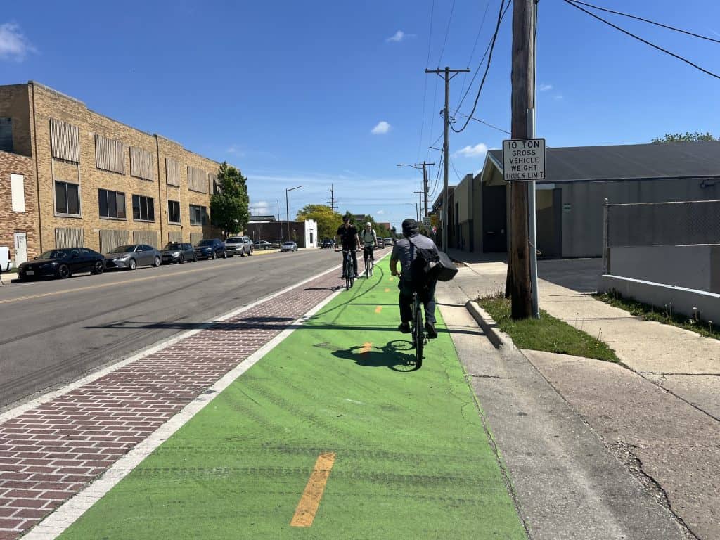
Aurora has long worked to identify bike routes through the city by “comfort” level — most, moderately and least comfortable. And that’s how streets are marked on its thorough map.
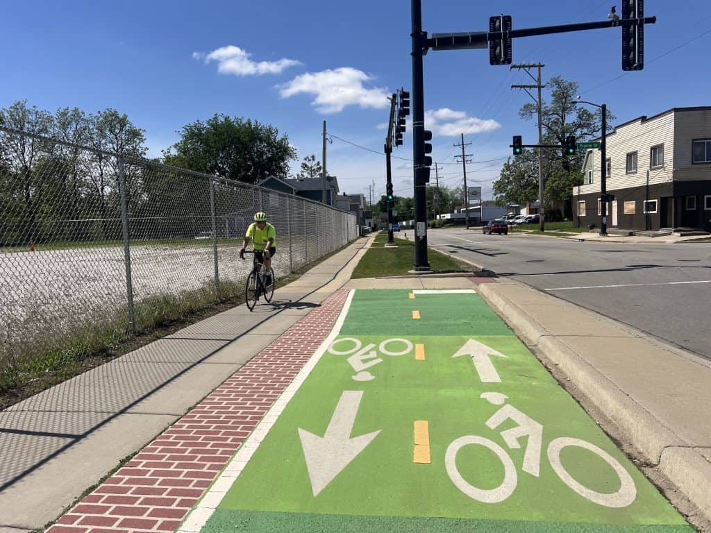
The system keeps bicyclists off busy streets like New York Street and Galena Blvd., but there are plenty of east-west and north-south options, like 5th Avenue, Ashland Avenue, Union Street and Highland Avenue.
There’s an off-road path along Orchard Road on the far west side. And the Virgil Gilman Trail runs through the city.
Aurora, with its advisory board and projects, has earned a League of American Bicyclists bike-friendly community designation. And now with its 2025 Bicycle and Pedestrian Plan, it’s looking to create more bicycling facilities like protected bike lanes and bike boulevards.
A protected or buffered, green-painted bike lane already does appear on River Street, after a little bit of Hoyt Place and Downer Place, as part of the Fox River Trail route; the protected portions are in front of retail and along the curb inside parking spaces.
St. Charles — bike lanes and sharrows, plus paths
The city of St. Charles has a comprehensive Bicycle and Pedestrian Plan and has been acting on it in the past couple of years. “Conventional bike lanes” were added to a portion of Fox Chase Blvd. in 2023. More than 300 sharrows were painted on “streets identified for shared use” in 2024, and 25 wayfinding and bike route signs were installed. The city is even proposing buffered bike lanes on 3rd Street, on which the Fox River Trail system runs for three-quarters of a mile, and which could tie with the city’s study of bicycling and pedestrian passages on nearby Riverside Avenue from Main Street/Route 64 to Illinois Avenue. St. Charles is looking into off-road paths in many locations like Dunham Road and Kirk Road, too.
Geneva, Batavia — making plans
Geneva and Batavia appear to be trying to catch up to St. Charles, even though they’re the ones that have received League of American Bicyclists bicycle-friendly community designations — Batavia is now at the bronze level while Geneva received an honorable mention for its 2024 application. While Geneva has had a Bike & Pedestrian Committee the past few years to help work on a bikeways plan created in 2022, the Geneva Park District has prepared a bike trail map, though it includes trails not under its jurisdiction like the Fox River Trail or the Illinois Prairie Path Geneva Spur.
Batavia created a Bike and Pedestrian Plan in 2023; one goal is to “build on the existing network of off-street trails, side paths, and local bikeways to create a connected bicycle network.” The city said in 2025 it is moving forward with a ramp up to Peace Bridge from the lower Fox River Trail on the east side of the river, allowing bicyclists to ride up to the bridge rather than climb stairs to get to it. The Peace Bridge leads to the Batavia Riverwalk, which circulates around a peninsula in the middle of the river, as well as to the Fox River Trail. The new ramp is scheduled to open in the spring of 2026.
Elgin — routes by “comfort” level, some painted lanes


Elgin has a mix of everything: some bike lanes, some sharrows, some bike route signage, and some off-road paths. Besides the Fox River Trail, there’s an off-road path along Congdon Avenue on the northeast side, several paths around Elgin Community College and the Elgin Country Club area on the south side of town, and others in parks and preserves.
On some streets in the downtown area, the city has bike lanes that are painted green; they’re nearest to traffic with parking inside them where there is street parking. The green bike lanes may be seen a little outside downtown, too, like on Wing Park Blvd.
Meanwhile, the city has an impressive map categorizing routes by comfort level (most, moderately, least). The assessments are good: Yes, Bode Road and Gifford Road are moderately comfortable for cyclists. Yes, the pretty Highland Road is least comfortable (and best for serious cyclists) as are Big Timber, Russell and Bowes roads in the open west.
You will find other bike lanes here and there, such as on Bluff City Blvd., where they’re a little rough.
Meanwhile, Elgin is working on an “Active Mobility Plan” now, collecting residents’ feedback on an online map.
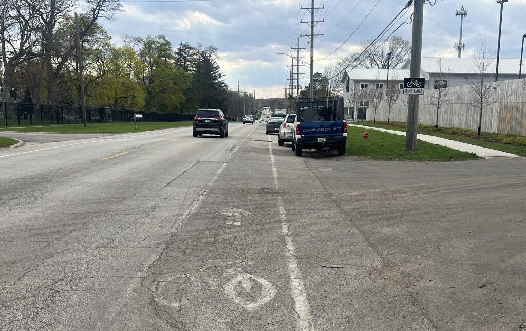
South Elgin, East Dundee, West Dundee, Carpentersville
Elgin’s neighbors to the north and south have no designated bike routes, even if it’s not too hard to navigate through them via the Fox River Trail or otherwise. East Dundee is working on a bike and pedestrian plan now, with a spring 2026 target date.
Pingree Grove
This kind of isolated, self-contained suburb west of Elgin has 10-foot paths, for the most part pretty new, off main roads through town, notably Reinking Road and Wester Blvd. Neighborhood streets are big and quiet enough for casual bicycling around.

South DuPage
Lombard, Villa Park, Elmhurst — plans, kinda
Lombard has had a Bicycle and Pedestrian Master Plan since 2016, and it has an interactive map showing existing and planned infrastructure. It shows Madison Avenue, for example, as an existing on-street bike route — I don’t recall signage on it — while it has many other roads showing proposed signage. Villa Park only steers riders to the DuPage County trails through town. Elmhurst has the very active Elmhurst Bicycle Club; its calendar shows rides seemingly everywhere but Elmhurst, but the club has gotten sharrows painted on some streets to offer bicyclists suggested routes. The city does have a Bicycle and Pedestrian Plan, last updated in 2020, but you have to find it on the “City Plan Documents” page of the city’s website.
Oak Brook — routes and paths
Oak Brook impressively has designated several bike routes through neighborhoods, but more notable are the off-road paths along major roads like 22nd Street, 31st Street (Oak Brook Road) and York Road to help riders get to the busy areas. Much of those are part of the Salt Creek Trail. The village has a nice Bike Route Map.
Downers Grove — many if split bike routes, limited bike lanes
Downers Grove created a thorough Active Transportation Plan in 2024 and 2025, building off its 2013 Bicycle and Pedestrian Plan. The new plan noted the village has 2.4 miles of bicycle lanes, 21.2 miles of bike routes marked with signs, 0.4 mile of sharrow routes, and 11.6 miles of “trails and park trails,” with no off-street paths or protected lanes.

The report offered plenty of criticism: “Bicycle routes are not located in proximity to residents south of 75th Street; or to residents along Fairview Avenue, near the Fairview Train Station; or to residents near Belmont Prairie,” one section says. “Bicycle routes do not connect to business centers along Butterfield Road east of I-355.”

On the positive side, the section notes: “Two primary bicycle routes run north-south along Fairmount Avenue and Dunham Road / Saratoga Avenue. Six bicycle routes run along east-west corridors, including Prentiss Drive / 67th Street, 59th Street, Gilbert Avenue / Curtiss Street, Warren Avenue / Rogers Street, Grant Street, and 39th Street. North-south connectivity is reliant on Downtown thoroughfares, as the only two railroad crossings are at Main Street and Washington Street.”
About signage, the report offered criticism, too. “While signage is typically found at the beginning and the end of designated bicycle routes, there is rarely signage within the middle of the routes,” it says. The report also cites limited bike lanes and bicyclists’ difficulty crossing intersections and getting around parked vehicles.
The village’s report says the 2013 plan suggested reducing lanes on some roads to create buffered bike lanes on both sides. It said implementation of the overall plan “was limited due to a variety of reasons” that included jurisdiction, residents’ apathy and right-of-way conflicts such as with trees and parking.
The new plan outlines several strategies for the short term and long term. It includes designating the downtown as an “Active Transportation Friendly District,” integrating bicycle facilities with public transit, and developing “a comprehensive wayfinding system for pedestrians and cyclists.” It talks of adopting a Complete Streets policy and promoting Downers Grove as a bicycle-friendly village with community bike rides and education.
Naperville — bike routes and off-road paths
The big city has had a comprehensive bike plan since 1997 that it has said it’s worked on each year. I believe it, looking at its bike map. Many neighborhood streets are labeled “preferred on-street bike routes.” Then there are off-road paths along bigger roads like Diehl Road, 75th Street, Hobson Road, Route 59, a piece of 95th Street and 248th Avenue. Trails such as the West Branch DuPage River Trail, and the Ashbury and Tall Park greenways also help riders get around, not to mention the Springbrook Prairie preserve is in town. It may take some weaving, but between routes and paths, you can get all the way north to south through the city. Now the city is taking residents’ feedback to update the bike plan as part of an overall “Naperville 2027” community plan.
Lisle — shared lanes and paths, with more plans
Meanwhile, Naperville’s neighbor updated its Bicycle and Pedestrian Plan in 2020, after an original in 2008. Lisle notes shared lanes already in its downtown; many more shared lanes and some bike lanes also have been proposed. There have been few updates except, in 2022, on a proposed connector path to the Metra station from Route 53.
North Shore
Evanston and southern North Shore — protected lanes and more
The college city of Evanston has done serious work for bicyclists. It has many designated bike routes north and south through the city, and then it also has some protected bike lanes — along Sheridan Road through the Northwestern campus, along much of Dodge Avenue, and along Church and Davis streets downtown and beyond.
Plans to improve Chicago Avenue with a protected bike lane also are in the works, as are plans for a protected bike lane on Church Street from Dodge Avenue to the city limits at the North Shore Channel; both of those may not happen until 2028 at the earliest.
The city has some off-street paths, too, most notably along the North Shore Channel. One street, Ridge Avenue, is specifically labeled not a bike route. A good map shows it all. The city is updating its bike plan in 2026, and it became a silver-level League of American Bicyclists Bicycle Friendly Community in late 2025.

Wilmette to the north has had extensive bike planning with a variety of facilities: bike lanes, shared lanes, even bike boulevards, plus a few paths. It has a League of American Bicyclists bike-friendly community designation. Winnetka and Glencoe lean on routes like the Green Bay Trail or Sheridan Road, which may or may not have a bike lane (and signs steer you away from “The Ravines,” a curvy and hilly section of Sheridan).
Highland Park, Fort Sheridan and northern North Shore
Highland Park touts a system, if a fragmented one, of trails, shared lanes (with sharrows) and routes with wayfinding signs. Sheridan Road, the Green Bay Trail and Skokie Valley Trail are major throughways. Routes steer you around downtown and the Metra station, though it can get a little tricky; see the map.
The city also provides a “Family Friendly Bikeway Tour,” a short loop on which families can ride. Ongoing work is part of the “Move HP Plan,” a 5-year update to “Bike-Walk HP 2030” that aims to add infrastructure and connectivity through the city. The suburb has a League of American Bicyclists bike-friendly community designation.
Fort Sheridan to the north offers bike route signage taking you through and around town as you wish (you can easily do loops on the generous roads) and to the Lake County forest preserve of the same name. Lake Forest and Lake Bluff lean on Sheridan Road and the North Shore Bike Path, but wow, neighborhood streets like Moffett Road and around Lake Forest College are beautiful, even if they’re not called bike routes.
Skokie — routes and lanes

Evanston’s neighbor to the west has a lot of designated bike routes in town as well as bike lanes, such as on Main Street, Howard Street and recently Church Street. Gross Point Road and Niles Center Road are called bike routes, but Dempster Street is not in any way.
Bike lanes are also proposed on Oakton Street; Cook County is working on that stretch.
Many cyclists for years had been riding Church Street already as a handy route between the North Branch Trail on the west and the North Shore Channel Trail along McCormick Blvd. to the east.
Of course there’s the Skokie Valley Trail on the west side of the village. See the map.
Northbrook — plans for a variety of facilities
Northbrook updated its 2017 Master Bicycle & Pedestrian Plan in 2022. It touted a mile of “conventional bike lanes” on Techny Road and Happ Road, and an additional 2.68 miles of streets with shared lane markings and 6.76 miles of signed bike routes guiding bicyclists to key destinations throughout the Village.”
The plan then proposes a variety of bicycling facilities: bike lanes, off-road paths, shared lanes and bicycle boulevards; it has a list of streets noting which facility each should get, and a separate list of which projects should come first (though they may be out of the village’s purview, like Dundee, Willow and Lake-Cook road sidepaths costing $5.4 million to $8.5 million each, under IDOT’s jurisdiction).
Safety measures particularly for pedestrians, like refuge islands and painted crosswalks, also are included. No timelines are included for the long list of suggested improvements, but a 1.5-mile stretch of Shermer Road, No. 2 on its priority list, was being resurfaced with an off-road path installed in 2025.
Glenview — plans for sharrows and signage to start
Glenview updated its 2007 Bicycle & Pedestrian Plan in 2023. It summarized its existing bicycling infrastructure and philosophy for the future in a bullet point on page 22: “Enhancing the overall bicycling experience can be achieved by improving convenience, safety, and comfort through the implementation of bike parking, increased off-street facilities, and clear signage.” It outlines projects over 19 years, in three phases.
I’ve heard that “Bike Route” signs, perhaps with wayfinding to key places, on streets such as Glenview Road could be in the works in the fall of 2026 through the spring of ’27. Adding sharrows to some streets was planned quickly. Then the second and third phases, scheduled for 2028-42, feature many plans for shared-used sidepaths or even “on-street facilities” on bigger streets like Willow Road, Lake Avenue, Landwehr Road, Pfingsten Road, Waukegan Road, Central Road and Glenview Road.
Connecting to regional trails — the Des Plaines River Trail is just west of Glenview, the North Branch Trail is just east — is listed as “a core objective,” and linking to neighboring towns and updating the village’s bike route map are priorities, as are community involvement and education. But no details on projects in the works nor the map itself are available on the village’s website (though maps are in the bike plan PDF). Glenview had been an official “bicycle-friendly community” at the “bronze” level up until 2015.
Lake County
Lake County overall has quite a system of bike paths, mostly gravel and not all quite connected just yet, that helps residents get around the county or even just their towns. But some suburbs have their own plans.

Grayslake, Gurnee — lotsa paths
Grayslake has earned bicycle-friendly community accolades for its system of off-road paths ingrained in its planning since 1989. “Since 1989, the bike path/trails have developed into a 21-mile system connecting all areas of the village,” its web page on bike trails says. It has a thorough map of the trails, even noting where it’s placed “bike route” signs. Gurnee doesn’t tout its bicycling so much, but thankfully there’s a path along Stearns School Road and a trail around Gurnee Mills, as well as the Almond Road Bike Path.
Libertyville — bike routes with more to come
Libertyville already has a network of bike routes, as shown on its bike path map, and it benefits from the county path off Park Avenue (Route 176) and its own path around Butler Lake. Now it has a comprehensive plan released in 2023 that recommends creating a lot of bicycling facilities, including marking shared lanes, establishing separate bike lanes and creating some off-road paths.
Vernon Hills — paths in parks
The village doesn’t tout a bike system, though there are trails in and through parks and greenways in town, including near Hawthorn Mall. Google Maps suggests some roads like Greggs Parkway are bike-friendly; your comfort level may vary.
Mundelein
Mundelein benefits from the county path along Hawley Street but otherwise has only a couple of little paths, and nothing official around its Diamond Lake.
Lake Zurich and Hawthorn Woods — unofficially rideable
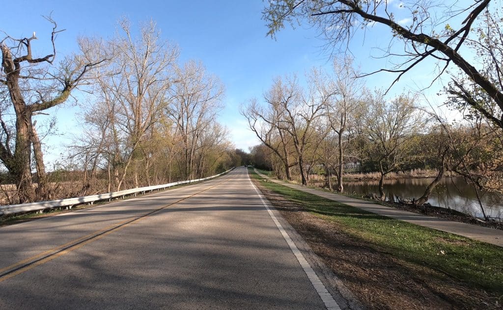
It’s possible to ride through Lake Zurich and around the actual lake, such as on Old Rand Road and Main Street, but nothing is officially a bike route. Same with the self-contained Hawthorn Woods: You can go into the subdivisions and ride around easily, but there are no paths or marked routes.
Wauconda — no official routes
You can ride Main Street by Bangs Lake and Phil’s Beach, and other roads around town, but though they’re fun especially in the summer, nothing is officially a bike route.
Island Lake, Lakemoor, Volo — roundabout way
No official bike routes in these towns, but paths are being built on Darrell Road, which connects the towns, as part of the roundabouts being installed.
Long Grove
Yes, it’s technically in Lake County, but see it under Cook County by Buffalo Grove above.
McHenry County
Richmond
This village just south of the Wisconsin border in 2025 presented an impressive 90-page bicycle and pedestrian plan after spending a year or so surveying and talking to residents. The recommendations strongly favor new off-road paths — 17 out of 33 miles of new bicycling infrastructure. Another 13.5 would be other trails. About 4 would be “bicycle boulevards,” or low-speed streets prioritizing bicycling. Only a mile would be a marked bike route or bike lane, while another 1.5 would just be a paved shoulder. The sidepaths along would cost $29 million, so implementing the plan is still to come.
Harvard
Harvard is developing its first bicycle-pedestrian plan. The campaign, with its own website separate from the city’s, is called “Harvard on the Moooove,” a nod to its trademark cow figurine in the center of town. Residents now can leave comments on an interactive map. The hope is the plan will be done in early 2026.
If you like this kind of information, please consider a donation to help keep this website running and up-to-date.


What a comprehensive assessment! Reading about the differences among towns reminds me how important it is to make your voice heard by city planners and leaders who make things happen (or don’t) for bicyclists.