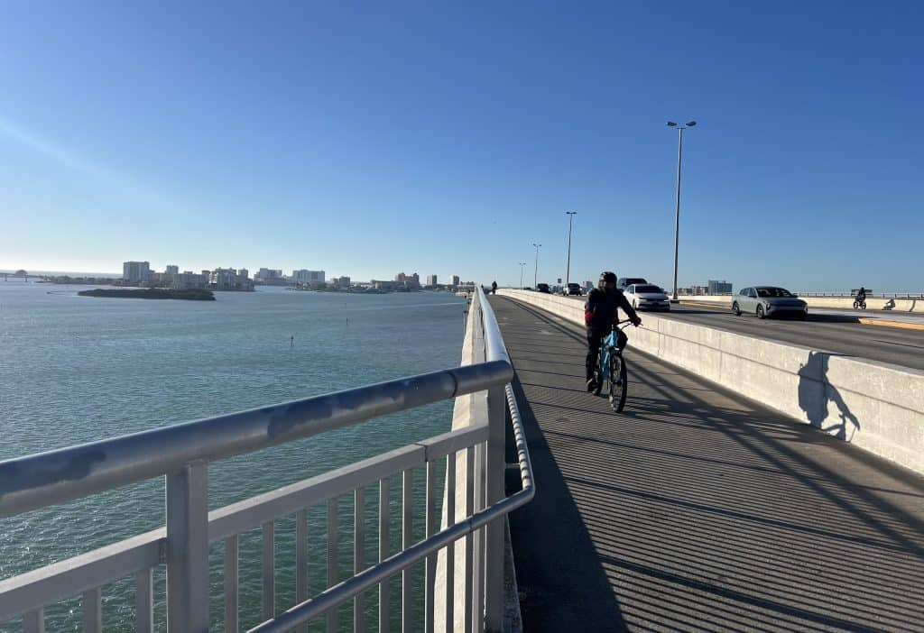
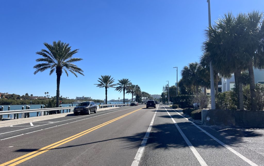
Above: The bridge from downtown Clearwater to Clearwater Beach shows all the buildings, water and sun you can bicycle by — slowly or not.
I’ve had occasion more than a few times over the years to visit the St. Petersburg-Clearwater, Florida, area, and quickly I noticed Gulf Blvd. on the map.
On the very west edge of the peninsula that hangs west of Tampa Bay is basically another peninsula itself — long, very thin, hardly a quarter-mile across at the widest points. It’s really a few islands, technically, connected by bridges. Gulf Blvd. runs nearly all the way down the strips of land — 23 miles.
You may not always feel like you’re riding right between Tampa Bay and the Gulf waters, but at points they’re right along both sides of you, and it’s fantastic. Plus on the north end the skyline of resorts is a stunning view itself, and along the way you sneak peeks at the Gulf beaches, down to the big one at the southern end.
As you may guess, it’s sunny and warm a lot. Even in February.
Start from Clearwater
I have always started riding Gulf Blvd. from the very top. But that requires accessing it from busy Clearwater Beach.
If you come from Clearwater proper, you’d cross the bay on the wide path along Causeway Blvd. (Route 60). Quickly you get your first amazing view — surrounded by sun and water (and a little traffic, too).
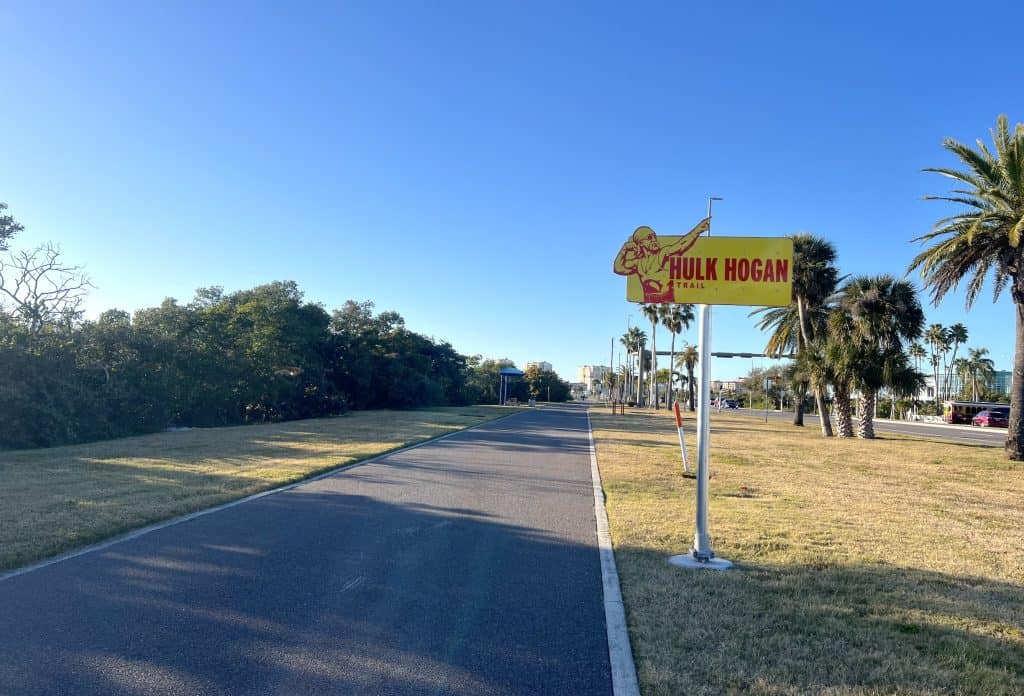
You’ll soon see you’re on Hulk Hogan Trail. The whole path actually is the Clearwater Trail, but two miles of it were renamed just in October 2025 for the famous pro wrestler who died the previous July.
Exercise equipment in Hogan’s trademark red and yellow colors line the stretch. Hogan, whose real name was Terry Bollea, supported various charitable initiatives in Florida.
Then you get to Clearwater Beach Island, where there’s a lot of dining and retail action. You take the roundabout south to Coronado Drive — probably riding right behind cars, because there’s no bike lane or path — then veer right onto Gulfview Blvd. That’s a little less busy and gives you a beach view.
It merges back with the main road, which becomes Gulf Blvd. And away you go.
Resort living
You won’t have a bike lane yet, but you’ll have a shoulder so you can get out of traffic. Then you can look to the right and see the resorts — colorful buildings of several stories, and elaborate signs and entrances.
Relaxed people mill about. The Gulf peeks through and white sand covers a lot of the ground — maybe even the road, so be alert.
Quickly you get another bridge — surrounded by the bright blue water and skies again. You arrive on Sand Key and pass a park of the same name, but it’s more resorts or upscale condos that you continue to pass for a while.
Here’s one driver’s video of the stretch from Clearwater Beach heading south.
In a couple of miles you reach Belleair Beach. Belleair Beach and its neighbor Belleair Shore are as elegant as they sound. Nevertheless, as you go south, the buildings start to get shorter and the surroundings a little more down-to-earth.
But the beaches and Gulf still shine through. This still ain’t the Chicago area.
Indian Rocks Beach and Indian Shores
Next you reach the bustling community of Indian Rocks Beach. There are a lot of small businesses getting car and foot traffic, but there’s also a lot of recreation afoot.
Indian Rocks Beach, the actual beach, appears quickly on the Gulf side. Local parks and recreation come on the left. That includes Indian Rocks Beach Nature Preserve, where you can park and take a little hike.
On the south end of town, on the bay side, is Splash Harbour Water Park. But it’s the real water that will catch your eye while riding. You enter the town of Indian Shores, and the strip of land gets really thin.
You’ll also get a real bike lane. In fact, Gulf Blvd. narrows to two lanes of auto traffic, and there’s not only the bike lane but also a pedestrian lane on each side. Little apartment buildings appear on the Gulf side, docks on the bay side.
Simpler living
Your bike lane luck runs out as you get into North Redington Beach and Redington Beach. Gulf Blvd. expands to a full five lanes of auto traffic, with a turn lane in the middle. You’ll have only sharrows in the right lane.
Fortunately residents throughout the Clearwater-St. Petersburg area respect bicyclists. Drivers usually will gently move over while you’re in the sharrow lane, or tarry behind while they wait for an opportunity to pass. They also respect pedestrians, who have many crosswalks and beacons at their disposal; bicyclists should yield to them, too.
You’ll pass mostly modest houses at this point, with some businesses, too, and less retail. Every now and then there are still public beaches; it’s rare that you don’t have the chance to peek at the Gulf.
The next town is Madeira Beach. Some resorts reemerge on the Gulf side while businesses ramp back up a bit amid the homes on the bay side. But you also get a bike lane back for a little while.

Homestretch to paradise
Then comes a bridge — over Johns Pass, which seems to be a destination of its own with resorts by the water. It’s fascinating hustling and bustling in paradise, yet you do lose the bike lane for a bit and traffic picks up.
But you continue on to Treasure Island. It has more beaches aplenty — “Treasure Island” also refers to basically a big beach along the Gulf — and again you’ll have at least a shoulder on the road.
Get through that and you’re on to St. Pete Beach (not St. Petersburg) and its big beach. This video, despite its label, starts at Johns Pass and proceeds through St. Pete Beach.
Here’s where you have a choice: Gulf Blvd. continues to an end on the particular island containing Treasure Island, and Sunset Beach lies on the south tip within a quiet residential area. It’s not a bad spot to view the Gulf and take a little respite.
Or Route 699, which Gulf Blvd. was, curves east to a bridge that crosses Blind Pass, and the route becomes Blind Pass Road. It’s busy, but it does have a bike lane.
Then Gulf Blvd. resumes! I found myself switching back west to it with a quick right and left on 75th Street. But that is a busy couple of intersections; you could try continuing on Blind Pass Road until it more naturally curves back to Gulf Blvd.


You’re continuing the main stretch south now, and soon you start to see a lot of water on both sides again. You make your way to the Pass-A-Grille Historic District.
This is a quaint residential area, Florida-style, and it has a long beach of the same name with an equally long, often busy parking lot.
You can circle around the district from the beach to ride along the quieter bay side, on Pass-A-Grille Way, and see the old homes.
The road will head back to Gulf Blvd. You’ve reached the bottom of the strips of land and you’re starting the return north!
More if you want it
If you want to go even further south, you can do this: Rather than proceed to the Pass-A-Grille area, you can turn east onto the Pinellas Bayway.
There’s a lot of traffic, and you have to make your way to a path a couple of blocks in. The path quickly crosses under the road to the other side, then allows you to continue for a while on a bridge crossing water.
Shortly after you cross that bridge, the bayway turns south to cross water again. That sends you to the town of Tierra Verde, then ultimately to Fort de Soto Park — strips of preserved land surrounding Mullet Key Bayou.
But getting down that far adds quite a few miles; you can probably tally 20 miles round-trip by riding from St. Pete Beach into Fort de Soto, sampling all the roads and paths there, and returning.
Another option is to keep going east on Pinellas Bayway, or Route 682, into St. Petersburg proper, crossing a couple more bridges on the way. You could ultimately make your way to the famous Pinellas Trail, which would take you north and then east to St. Pete’s edge, or west through the rest of town and up into several others over many, many miles.
Cruise the road
But the Pinellas Trail ride is much like suburban trail riding. Gulf Blvd. offers the thrill of coastal riding with so much to see — the luxurious resorts, the beaches, or the simpler waterfront communities. Plus plenty of sun and sky.
I have tended to ride Gulf Blvd. when it’s not so hot. It was in the 50s (cold for Floridians!) while I was there in February and climbed into the low 60s. A west breeze off the Gulf could be cool.
And a breeze could make the trip back north difficult. If you do the full 25+ miles one way and want to return for a 50-miler, you might find yourself tired in the end. But the cruise south sure is fun!
• Did you enjoy the trip? This free website is made possible almost entirely by readers like you. Consider donating to help defray the costs of gathering and presenting this material.