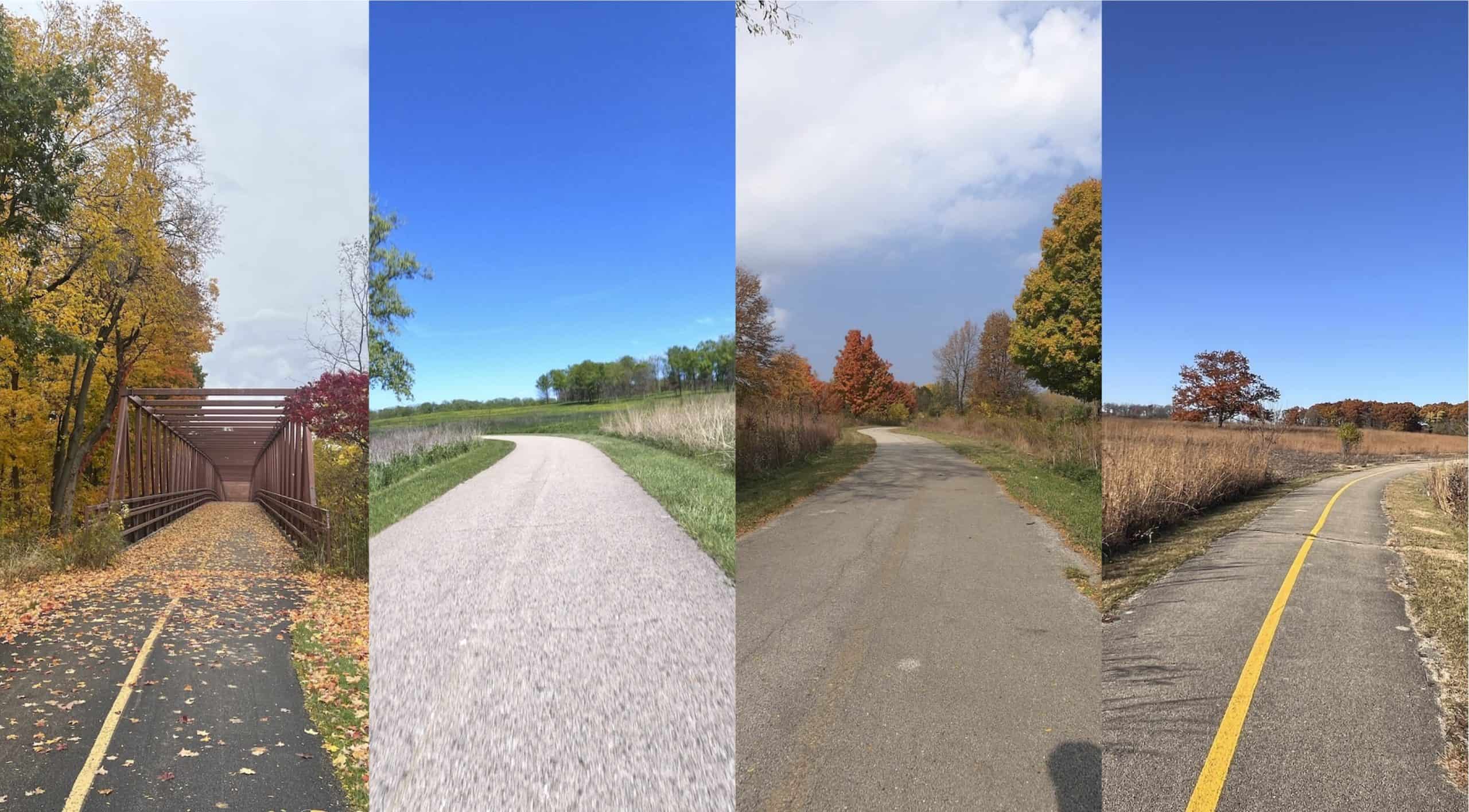
My home base of Schaumburg gives me pretty easy access to four major northwest Cook County forest preserve trails. I suspect it’s the same for many bicyclists in the suburbs here.
The Poplar Creek Trail is closest to me. Busse Woods is about 7 miles to the east. The Paul Douglas Trail is about that far to the north. And the Deer Grove trails are the farthest, but I can still get there in about 13 miles.
Now imagine riding all of them in one grand round trip.
That’s what Bill Triplett has done. He says he’s ridden around the northwest suburbs for 50 years, even if less nowadays than he used to.
“I have seen roads that were great for bikes become overwhelmed with traffic but also have seen many bike paths put in,” he told me.
He has a dream of getting those four bike trails safely connected with bicycling infrastructure.
“The problem is most lack enough <surrounding> good bike routes to get to the preserves such that many casual riders have to take their bikes by car to ride there. And the trail lengths in the preserves are relatively short,” he wrote. “… There are bike routes and local streets that sort of connect, but a few more paths and signage would make it more rideable and enjoyable by the casual rider.”
This is the “paths to the paths” problem that engineers and planners have observed.
In the meantime, he’s developed a 52-mile route to travel the four trails in a single ride around the suburbs. It’s pretty safe, but given the distance and because some riding on busy local streets is required, it’s still, as Bill suggests, better for serious cyclists than for casual bicyclists.
Start at Busse Woods
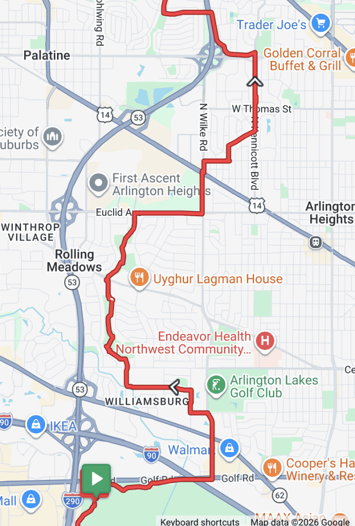
For his official route on the Ride with GPS app, Bill has chosen to begin the loop at a Busse Woods offshoot near Golf Road and I-290, just east of Schaumburg. The route follows the trail east to New Wilke Road.
Quickly he veers west and north into residential Rolling Meadows, passing the high school and then picking up a path through South Calk and Kimball Hill parks.
He gets onto the path off Euclid Avenue and heads back to New Wilke, soon weaving east into Arlington Heights and Kennicott Blvd. — part of the village’s official north-south bike route.
This is one area where Bill and I differ, as I go into Arlington Heights altogether by picking up the bike route off White Oak Street.
That does mean a difficult road or sidewalk dash along New Wilke for a longer stretch. I should try Bill’s way.
But we both ultimately get to Anderson Drive, which takes us under Route 53 west from Arlington Heights into Palatine. The Palatine Trail can get you to Deer Grove.
Deer Grove
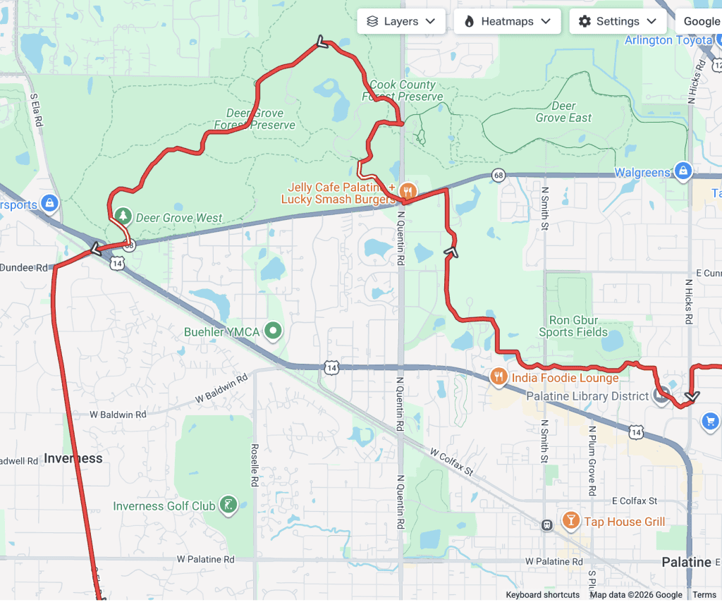
There are also different approaches to Deer Grove, Cook County’s first forest preserve. Bill’s official route takes the Palatine Trail all the way into Deer Grove West, crossing the intersection of Quentin and Dundee roads.
This west, more forested side of Deer Grove has a 5.5-mile unpaved loop (the yellow trail) plus a 1.5-mile roughly paved path, really an old park road, through the middle (orange). Their quality varies, with maybe the beat-up old pavement, rough dirt and some rocks, or maybe smooth gravel in other spots. Bill largely uses the orange.
He ultimately escapes Deer Grove at its southwest corner, venturing onto Dundee Road to get to Ela Road. That can be a little busy there, but Dundee at least has a good shoulder.
The different approach that I and sometimes Bill take to Deer Grove has us using some of the Palatine Trail but also the neighborhood roads between Hicks Road and Smith Street. Then Smith goes all the way to the bike path entrance across Dundee Road.
That goes to the 2.8-mile paved loop in Deer Grove East, which we can ride and then exit back out onto Smith Street.
Approaches to Paul Douglas
Bill next rides Ela Road all the way back to Algonquin Road (Route 62), where he picks up the Paul Douglas trail.
Ela Road is a concern for us. It’s a common north-south throughway for bicyclists, extending all the way into Lake County to Lake Zurich, with a little hiccup around Dundee Road and Northwest Highway. But there’s no bicycling infrastructure on it.
The Cook County end of Ela is about to be resurfaced from Dundee to its end at Central Road, on the south end of Paul Douglas. We’re hoping Ela’s shoulders are maintained and improved to be at least 3 feet wide along the whole road.
I usually take a different path to Paul Douglas. I take Smith Street out of Deer Grove back south to Palatine’s downtown. I work my way through the neighborhoods and get to Cedar Street, which I take to Illinois Avenue.
I then turn onto an on-street bike route that takes me to a little path that’s sometimes (somehow) also called the Palatine Trail, which takes me to and through the Harper College campus. I continue on the path across Euclid Avenue, riding to the side of Roselle Road until I get to the busy Roselle-Algonquin intersection. That’s scary to cross even when you follow all the lights.
But I end up on Paul Douglas, where Bill and I resume largely the same path.
To and around Poplar Creek
You can go whichever direction on the 7-mile paved Paul Douglas loop (Paul Douglas is also becoming popular for the mountain bike trails within the trees), but the tour takes us out the southwest corner and into the north Hoffman Estates industrial area, where the Bellworks (former AT&T) campus is.
We make our way back to Central Road and take that bumpy street to Barrington Road, which has a path to cross the tollway (but watch those exit and entrance ramps).
At Hassell Road, we cross Barrington and wend through the motels and restaurants, then cross Higgins Road to get onto the Poplar Creek Trail.
This 9-mile paved loop features forested and prairie sections. You’ll also sometimes cross busy streets, including Route 59, Bartlett Road and Golf Road, so this trail is better when it’s not rush hour.
Bill’s tour has us leaving Poplar Creek at Bode and Barrington roads and east into Schaumburg. It follows neighborhood bike lanes, particularly on Braintree Drive and Weathersfield Way, to ultimately travel into Elk Grove Village.
Back to Busse
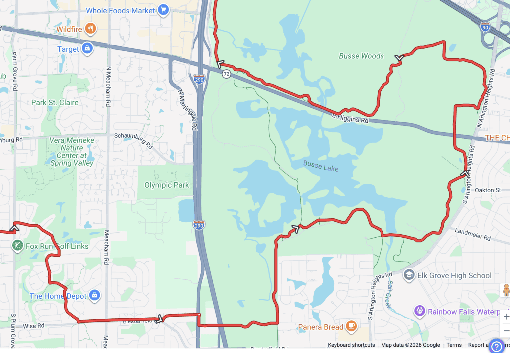
The route makes its way through Elk Grove neighborhoods to a path along Biesterfield Road. Then we follow the Bike Route signs to the “community bridge” over I-290 and back into Busse Woods.
Now we’re on the southwest end of this popular trail — which serious cyclists really should avoid on nice weekends because it’s so busy. The trail here actually is another offshoot that leads to the main, 7.25-mile loop. And yes, you’ll see that loop is shaped like a duck.
On the north side of Higgins, before the westernmost of the two bridges over Higgins, is another offshoot that heads toward Golf Road. And voila, the route soon ends where it started. 52 miles!
There really are not too many uncomfortable stretches on this big route, remarkably. But wouldn’t it be nice if there were official, protected and marked connections for everyone? Thanks for putting this together, Bill.
• Do you find this tour fun? This free website is made possible almost entirely by readers like you (and Bill). Consider donating to help defray the costs of gathering and presenting this material.